Île Australia
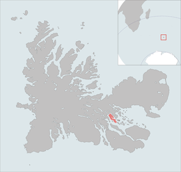 The Île Australia is highlighted on this Kerguelen Islands map. | |
| Geography | |
|---|---|
| Location | Indian Ocean |
| Coordinates | 49°27′S 69°50′E / 49.450°S 69.833°ECoordinates: 49°27′S 69°50′E / 49.450°S 69.833°E |
| Archipelago | Îles Kerguelen |
| Area | 37 km2 (14 sq mi)[1] |
| Length | 10 km (6 mi)[2] |
| Width | 3 km (1.9 mi)[2] |
| Highest elevation | 145 m (476 ft).[2] |
| Administration | |
| District | Îles Kerguelen |
| Demographics | |
| Population | 0 |
Île Australia, also known as Île aux Rennes [1] (Reindeer Island) is one of the Kerguelen Islands situated in the Golfe du Morbihan near the coast of Grande Terre, the principal island.
It is around 10 km long and 3 km wide. The highest spot is Le stack de Tome at 145 metres.
References
- 1 2 Tableau général de la France d'outremer, r.Brunet, Mappemonde nr.54, 1999; on General view of non-metropolitan France, Maison de la Géographie.
- 1 2 3 Kerguelen islands map, Géoportail IGN
This article is issued from Wikipedia - version of the 10/22/2016. The text is available under the Creative Commons Attribution/Share Alike but additional terms may apply for the media files.