Addington Parish, New Brunswick
For homonymy, see Addington.
| Addington | |
|---|---|
| Parish | |
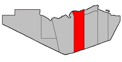 Location within Restigouche County. | |
| Coordinates: 47°42′28″N 66°45′40″W / 47.707777°N 66.76111°WCoordinates: 47°42′28″N 66°45′40″W / 47.707777°N 66.76111°W | |
| Country |
|
| Province |
|
| County | Restigouche |
| Established | 1826 |
| Area[1] | |
| • Land | 1,024.99 km2 (395.75 sq mi) |
| Population (2011)[1] | |
| • Total | 2,615 |
| • Density | 2.6/km2 (7/sq mi) |
| • Pop 2006-2011 |
|
| • Dwellings | 1,086 |
| Time zone | AST (UTC-4) |
| • Summer (DST) | ADT (UTC-3) |
Addington is a Canadian parish in Restigouche County, New Brunswick.[2]
Delineation
Addington Parish is described in the Territorial Division Act[3] as being bounded
- West by Eldon Parish; north by the Province of Quebec; south by the Northumberland County line; and east by a line running true south from the most eastern point of the western side of the mouth of Walkers Brook,[lower-alpha 1] including all the islands in front in the Restigouche River which belong to this Province.
Communities
Parish population total does not include incorporated municipalities (in bold).
Demographics
Population
| Canada census – Addington Parish, New Brunswick community profile | |||
|---|---|---|---|
| 2011 | 2006 | 2001 | |
| Population: | 2,615 (-4.1% from 2006) | 2,727 (-8.6% from 2001) | 2,982 (-1.1% from 1996) |
| Land area: | 1,024.99 km2 (395.75 sq mi) | 1,024.99 km2 (395.75 sq mi) | 1,025.03 km2 (395.77 sq mi) |
| Population density: | 2.6/km2 (6.7/sq mi) | 2.7/km2 (7.0/sq mi) | 2.9/km2 (7.5/sq mi) |
| Median age: | 46.6 (M: 46.6, F: 46.6) | 41.9 (M: 41.7, F: 42.0) | 37.4 (M: 37.5, F: 37.3) |
| Total private dwellings: | 1,086 | 1,080 | 1,099 |
| Median household income: | $47,794 | $37,279 | $32,223 |
| References: 2011[4] 2006[5] 2001[6] | |||
| Historical Census Data - Addington Parish, New Brunswick[7] | ||||||||||||||||||||||||||
|---|---|---|---|---|---|---|---|---|---|---|---|---|---|---|---|---|---|---|---|---|---|---|---|---|---|---|
|
|
| ||||||||||||||||||||||||
Language
| Canada Census Mother Tongue - Addington Parish, New Brunswick[7] | ||||||||||||||||||
|---|---|---|---|---|---|---|---|---|---|---|---|---|---|---|---|---|---|---|
| Census | Total | French |
English |
French & English |
Other | |||||||||||||
| Year | Responses | Count | Trend | Pop % | Count | Trend | Pop % | Count | Trend | Pop % | Count | Trend | Pop % | |||||
| 2011 |
2,610 |
1,950 | |
74.71% | 630 | |
24.14% | 30 | |
1.15% | 0 | |
0.00% | |||||
| 2006 |
2,720 |
2,000 | |
73.53% | 685 | |
25.18% | 25 | |
0.92% | 10 | |
0.37% | |||||
| 2001 |
2,990 |
2,315 | |
77.42% | 645 | |
21.57% | 20 | |
0.67% | 10 | |
0.33% | |||||
| 1996 |
2,995 |
2,150 | n/a | 71.79% | 785 | n/a | 26.21% | 40 | n/a | 1.33% | 20 | n/a | 0.67% | |||||
Access Routes
Highways and numbered routes that run through the parish, including external routes that start or finish at the parish limits:[8]
|
|
See also
- List of parishes in New Brunswick
- Popelogan River
- Upsalquitch River
- Upsalquitch Southeast River
- Little Upsalquitch Southeast River
- Upsalquitch Northwest River
Footnotes
- ↑ Now officially called Walker Brook.
References
- 1 2 2011 Statistics Canada Census Profile: Addington Parish, New Brunswick
- ↑ New Brunswick Provincial Archives - Addington Parish
- ↑ "Territorial Division Act (R.S.N.B. 1973, c. T-3)". Government of New Brunswick website. Retrieved 17 August 2016.
- ↑ "2011 Community Profiles". Canada 2011 Census. Statistics Canada. July 5, 2013. Retrieved 2014-03-16.
- ↑ "2006 Community Profiles". Canada 2006 Census. Statistics Canada. March 30, 2011. Retrieved 2014-03-16.
- ↑ "2001 Community Profiles". Canada 2001 Census. Statistics Canada. February 17, 2012. Retrieved 2014-03-16.
- 1 2 Statistics Canada: 1996, 2001, 2006, 2011 census
- ↑ Atlantic Canada Back Road Atlas ISBN 978-1-55368-618-7 Pages 5, 14
 |
|
Dalhousie Parish | | |
| Eldon Parish | |
Balmoral Parish | ||
| ||||
| | ||||
| Northesk Parish (Northumberland County) |
| Subdivisions | |
|---|---|
| Cities | |
| Counties | |
| |
This article is issued from Wikipedia - version of the 8/17/2016. The text is available under the Creative Commons Attribution/Share Alike but additional terms may apply for the media files.