Aiguilles
| Aiguilles | ||
|---|---|---|
|
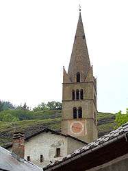
The bell tower of the church of Saint-Jean-Baptiste | ||
| ||
 Aiguilles | ||
|
Location within Provence-A.-C.d'A. region 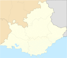 Aiguilles | ||
| Coordinates: 44°46′57″N 6°52′11″E / 44.7825°N 6.8697°ECoordinates: 44°46′57″N 6°52′11″E / 44.7825°N 6.8697°E | ||
| Country | France | |
| Region | Provence-Alpes-Côte d'Azur | |
| Department | Hautes-Alpes | |
| Arrondissement | Briançon | |
| Canton | Aiguilles | |
| Intercommunality | Queyras | |
| Government | ||
| • Mayor (2014–2020) | Serge Laurens[1] | |
| Area1 | 40.16 km2 (15.51 sq mi) | |
| Population (2012)2 | 449 | |
| • Density | 11/km2 (29/sq mi) | |
| Time zone | CET (UTC+1) | |
| • Summer (DST) | CEST (UTC+2) | |
| INSEE/Postal code | 05003 / 05470 | |
| Elevation |
1,400–3,078 m (4,593–10,098 ft) (avg. 1,471 m or 4,826 ft) | |
|
1 French Land Register data, which excludes lakes, ponds, glaciers > 1 km² (0.386 sq mi or 247 acres) and river estuaries. 2 Population without double counting: residents of multiple communes (e.g., students and military personnel) only counted once. | ||

Aiguilles is a commune of the Hautes-Alpes department in southeastern France.
Geography
The village lies in the middle of the commune, on the right bank of the Guil, which flows southwest through the commune.
Population
| Historical population | ||
|---|---|---|
| Year | Pop. | ±% |
| 1936 | 324 | — |
| 1954 | 300 | −7.4% |
| 1962 | 248 | −17.3% |
| 1968 | 249 | +0.4% |
| 1975 | 275 | +10.4% |
| 1982 | 310 | +12.7% |
| 1990 | 377 | +21.6% |
| 1999 | 441 | +17.0% |
| 2008 | 419 | −5.0% |
| 2012 | 449 | +7.2% |
See also
References
- ↑ "List of mayors of the Hautes-Alpes department". Prefecture of Hautes-Alpes (in French). 3 June 2014. Retrieved 20 March 2015.
| Wikimedia Commons has media related to Aiguilles. |
This article is issued from Wikipedia - version of the 3/20/2015. The text is available under the Creative Commons Attribution/Share Alike but additional terms may apply for the media files.