Allerthorpe
| Allerthorpe | |
 Allerthorpe |
|
| Population | 220 (2011 census)[1] |
|---|---|
| OS grid reference | SE784474 |
| – London | 170 mi (270 km) S |
| Civil parish | Allerthorpe |
| Unitary authority | East Riding of Yorkshire |
| Ceremonial county | East Riding of Yorkshire |
| Region | Yorkshire and the Humber |
| Country | England |
| Sovereign state | United Kingdom |
| Post town | YORK |
| Postcode district | YO42 |
| Dialling code | 01759 |
| Police | Humberside |
| Fire | Humberside |
| Ambulance | Yorkshire |
| EU Parliament | Yorkshire and the Humber |
| UK Parliament | East Yorkshire |
Coordinates: 53°55′01″N 0°48′28″W / 53.916821°N 0.807680°W
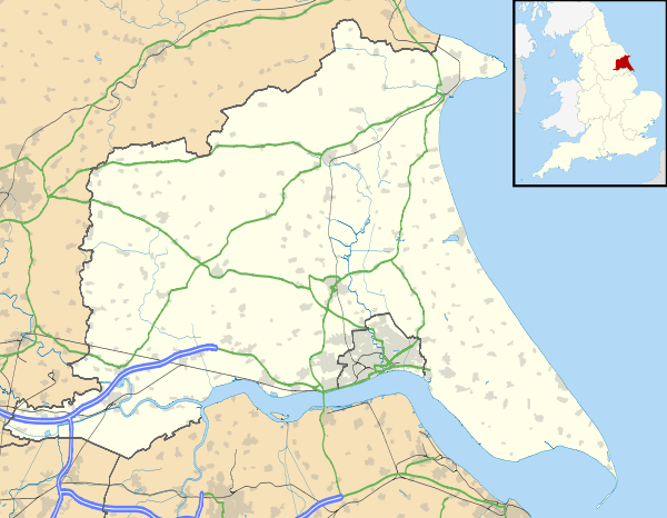
Allerthorpe is a village and civil parish in the East Riding of Yorkshire, England. It is situated approximately 1.5 miles (2.4 km) south-west from the town of Pocklington.
The civil parish is formed by the village of Allerthorpe and the hamlet of Waplington. According to the 2011 UK census, Allerthorpe parish had a population of 220,[1] a slight reduction from the 2001 UK census figure of 223.[2] The parish covers an area of 969.217 hectares (2,394.99 acres).[3]
Allerthorpe has a public house cum restaurant, The Plough Inn, an 18-hole golf course and a lake used for water sports and fishing. Allerthorpe Common, to the west of the village, has a nature reserve.
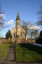
Allerthorpe's Victorian Grade II listed Anglican parish church is dedicated to St Botolph.[4]
The K6 telephone box on Main Street is Grade II listed.[5]
Thomas Cooke, the machinist and optical instrument maker, was born here.[6] There is a memorial stone to him near the church gate and a blue plaque was unveiled in the village hall in 2009.[7]
William Dewsbury the Quaker minister was born in the village.[8]
References
- 1 2 "Key Figures for 2011 Census: Key Statistics: Area: Allerthorpe CP (Parish)". Neighbourhood Statistics. Office for National Statistics. Retrieved 2 February 2013.
- ↑ "2001 Census: Key Statistics: Parish Headcounts: Area: Allerthorpe CP (Parish)". Neighbourhood Statistics. Office for National Statistics. Retrieved 14 May 2008.
- ↑ "2001 Census Area Profile" (PDF). East Riding of Yorkshire County Council. 2004. Retrieved 10 April 2013.
- ↑ Historic England. "Church of St Botolph (1083874)". National Heritage List for England. Retrieved 16 December 2011.
- ↑ Historic England. "K6 telephone kiosk (1261988)". National Heritage List for England. Retrieved 26 February 2013.
- ↑ Clerke, A M (2004). "Cooke, Thomas (1807–1868)". Oxford Dictionary of National Biography. Oxford University Press. Retrieved 8 December 2009.(subscription or UK public library membership required)
- ↑ "Blue plaque for Allerthorpe's most famous son". Driffield Times & Post. 31 July 2009. Retrieved 13 March 2013.
- ↑ Gill, Catie (2004). "Dewsbury, William (c.1621–1688)". Oxford Dictionary of National Biography. Oxford University Press. Retrieved 26 February 2013.(subscription or UK public library membership required)
- Gazetteer — A–Z of Towns Villages and Hamlets. East Riding of Yorkshire Council. 2006. p. 3.
External links
 Media related to Allerthorpe at Wikimedia Commons
- Allerthorpe Common Nature Reserve
- Historic England. "Details from image database (167623)". Images of England. - St Botolph's Church
- Allerthorpe in the Domesday Book