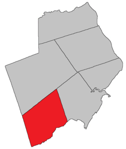
Alma Parish, New Brunswick
Alma is a Canadian parish in Albert County, New Brunswick.[2]
Alma Parish includes most of Fundy National Park.
History
Alma Parish was set off from Harvey Parish in 1855: named for the heights above the Alma River in Crimea where the British forces won a major battle in 1855.
Delineation
Alma Parish is defined in the Territorial Division Act[3] as being bounded:
- North by the westerly prolongation of the northern boundary of Harvey Parish; west by the County line; south by Chignecto Bay, and east by Harvey Parish.
Communities
Parish population total does not include incorporated municipalities (in bold).
Demographics
Population
| Canada census – Alma Parish, New Brunswick community profile |
|---|
| |
2011 |
2006 |
2001 |
| Population: |
0 (-100.0% from 2006) |
5 (0.0% from 2001) |
5 (-37.5% from 1996) |
| Land area: |
222.79 km2 (86.02 sq mi) |
222.79 km2 (86.02 sq mi) |
222.79 km2 (86.02 sq mi) |
| Population density: |
0.0/km2 (0/sq mi) |
0.0/km2 (0/sq mi) |
0.0/km2 (0/sq mi) |
| Median age: |
n/a (M: n/a, F: n/a) |
n/a (M: n/a, F: n/a) |
n/a (M: n/a, F: n/a) |
| Total private dwellings: |
7 |
6 |
2 |
| Median household income: |
$.N/A |
$.N/A |
$.N/A |
| Notes: Income & median age data for this area has been suppressed for data quality or confidentiality reasons. – References: 2011[4] 2006[5] 2001[6] |
| Historical Census Data - Alma Parish, New Brunswick[7] |
|---|
| Year | Pop. | ±% |
|---|
| 1996 | 8 | — |
|---|
| 2001 | 5 | −37.5% |
|---|
| | Year | Pop. | ±% |
|---|
| 2006 | 5 | +0.0% |
|---|
| 2011 | 0 | −100.0% |
|---|
|
Access routes
Highways and numbered routes that run through the parish, including external routes that start or finish at the parish limits:[8]
See also
References
|
|---|
|
| Subdivisions | |
|---|
|
| Cities | |
|---|
|
| Counties | |
|---|
|
-
 Category:New Brunswick Category:New Brunswick
-
 Portal:New Brunswick Portal:New Brunswick
-
 WikiProject:New Brunswick WikiProject:New Brunswick
|