Andrejci
| Andrejci Andorhegy | |
|---|---|
 Andrejci Location in Slovenia | |
| Coordinates: 46°43′18.93″N 16°13′27.71″E / 46.7219250°N 16.2243639°ECoordinates: 46°43′18.93″N 16°13′27.71″E / 46.7219250°N 16.2243639°E | |
| Country |
|
| Traditional region | Prekmurje |
| Statistical region | Mura |
| Municipality | Moravske Toplice |
| Area | |
| • Total | 5.07 km2 (1.96 sq mi) |
| Elevation | 290.8 m (954.1 ft) |
| Population (2002) | |
| • Total | 222 |
| [1] | |
Andrejci (pronounced [anˈdɾeːi̯tsi]; Hungarian: Andorhegy) is a settlement north of Martjanci in the Municipality of Moravske Toplice in the Prekmurje region of Slovenia.[2]
There is a small Lutheran chapel with a three-storey belfry in the settlement. It was built in 1925.[3]
References
External links
 Media related to Andrejci at Wikimedia Commons
- Andrejci on Geopedia
| Settlements | 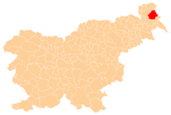 | |
|---|---|---|
| Landmarks |
| |
| Notable people |
| |
This article is issued from Wikipedia - version of the 5/2/2016. The text is available under the Creative Commons Attribution/Share Alike but additional terms may apply for the media files.