Arenig Fawr South Top
| Arenig Fawr South Top | |
|---|---|
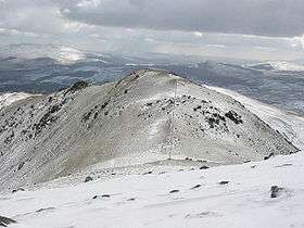 Arenig Fawr South Top from the summit of Arenig Fawr | |
| Highest point | |
| Elevation | 836 m (2,743 ft) |
| Prominence | 15 m (49 ft) |
| Parent peak | Arenig Fawr |
| Listing | Nuttall |
| Naming | |
| Translation | Great High Ground (Welsh) |
| Pronunciation | Welsh: [aˈrɛnɪɡ ˈvaur] |
| Geography | |
| Location | Gwynedd, Wales |
| Parent range | Snowdonia |
| OS grid | SH827370 |
| Topo map | OS Landranger 124 |
Arenig Fawr South Top is the twin top of Arenig Fawr in southern Snowdonia, North Wales. It is the second highest member of the Arenig range, being 18 m less than its twin. From here the south ridge continues into an area of rocky knolls and small tarns, where Arenig Fawr South Ridge Top can be found.[1]
References
- ↑ Nuttall, John & Anne (1999). The Mountains of England & Wales - Volume 1: Wales (2nd edition ed.). Milnthorpe, Cumbria: Cicerone. ISBN 1-85284-304-7.
External links
Coordinates: 52°55′03″N 3°44′46″W / 52.91757°N 3.74601°W
This article is issued from Wikipedia - version of the 1/24/2016. The text is available under the Creative Commons Attribution/Share Alike but additional terms may apply for the media files.