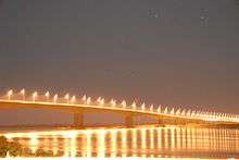
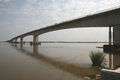
Armando Emilio Guebuza Bridge
| Armando Emilio Guebuza Bridge Portuguese: Ponte Armando Emílio Guebuza | |
|---|---|
 | |
| Coordinates | 17°48′29″S 35°23′51″E / 17.8081°S 35.3975°ECoordinates: 17°48′29″S 35°23′51″E / 17.8081°S 35.3975°E |
| Carries | EN1 (2 lanes) |
| Crosses | Zambezi River |
| Locale | Caia and Chimuara |
| Other name(s) | Zambezi River Bridge |
| Maintained by | National Road Administration |
| Preceded by | Dona Ana Bridge |
| Characteristics | |
| Design | Box girder bridge |
| Total length | 2,376 metres (7,795 ft) |
| Width | 16 metres (52 ft) |
| Number of spans | 6 |
| History | |
| Designer | WSP Group |
| Constructed by |
Mota-Engil Soares da Costa |
| Construction begin | December 2005 |
| Construction cost | € 66 million |
| Inaugurated | 1 August 2009 |
| Replaces | Ferry service |
| Statistics | |
| Toll |
US$ 3 (light vehicles) US$ 30 (trucks) |
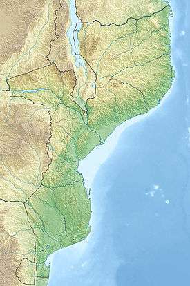 Armando Emilio Guebuza Bridge Location in Mozambique | |
Armando Emilio Guebuza Bridge is a bridge in Mozambique that crosses the Zambezi River. It connects the provinces of Sofala and Zambezia.[1][2] It is named after Armando Guebuza, the President of Mozambique.
Gallery
-
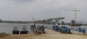
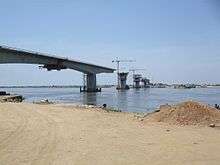
Under construction
-
-
See also
References
- ↑ "Zambezi Bridge inaugurated". High Commission of the Republic of Mozambique in London. 5 August 2009. Retrieved 8 March 2013.
- ↑ "New bridge unites Mozambique". Swedish International Development Cooperation Agency. 7 September 2009. Retrieved 8 March 2013.
External links
This article is issued from Wikipedia - version of the 10/18/2016. The text is available under the Creative Commons Attribution/Share Alike but additional terms may apply for the media files.