Artillery Mountains
| Artillery Mountains | |
|---|---|
|
Artillery Peak above Alamo Lake State Park | |
| Highest point | |
| Peak | Artillery Peak-(volcanic plug) |
| Elevation | 1,200 ft (370 m) |
| Dimensions | |
| Length | 12 mi (19 km) NW x E |
| Width | 5 mi (8.0 km) |
| Geography | |
| Country | United States |
| State | Arizona |
| Borders on |
Big Sandy River–Arrastra Mountain Wilderness-N & E Alamo Lake State Park-S Rawhide Mountains & Wilderness-SW |
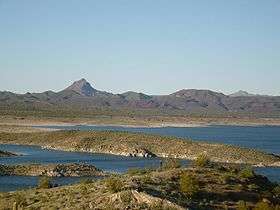
The Artillery Mountains are a mountain range in Mohave County in western Arizona. High point of the range is Artillery Peak, 2,917 feet (889 meters) above sea level. Artillery Peak is at coordinates N 34.36946 W 113.58160 .
Mineral resources of the Artillery Mountains include manganese, uranium and gold. Rocher Deboule Minerals drilled their Artillery Mountains Manganese property in 2008, and discovered a resource of 2,553,000 tonnes of 3.82% Mn.[1]
High Desert Gold acquired the Artillery Peak gold project in western Arizona in 2008. The company believes the site has the potential to "develop into a bulk mineable target".[2]
At Uranium Energy's Artillery Peak uranium project, the firm hopes to discover a uranium deposit similar to the nearby Anderson Mine, which has a published reserve of 27 million pounds of uranium, in addition to a uranium resource of 70 million pounds, and another 80 million pounds of vanadium.[3]
References
Coordinates: 34°22′04″N 113°36′04″W / 34.3677961°N 113.6010425°W