Ashwicken
| Ashwicken | |
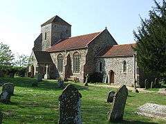 All Saints parish church, Ashwicken, Norfolk |
|
 Ashwicken |
|
| OS grid reference | TF7019 |
|---|---|
| District | King's Lynn and West Norfolk |
| Shire county | Norfolk |
| Region | East |
| Country | England |
| Sovereign state | United Kingdom |
| Post town | King's Lynn |
| Postcode district | PE32 |
| EU Parliament | East of England |
Coordinates: 52°44′N 0°31′E / 52.74°N 00.51°E
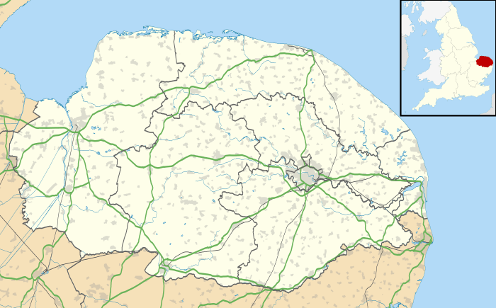
Ashwicken is a small village in the English county of Norfolk.[1] The village sits on the B1145[2] Kings Lynn to Mundesley road around 5 miles (8.0 km) east of Kings Lynn. The village was united with the civil parish of Leziate in the 15th century.[3]
Ashwicken is the site of a shrunken medieval village, one of around 200 lost settlements in Norfolk.[3][4] The remains of the village were visible as earthworks near to Ashwicken Hall but were partly destroyed by ploughing in the 1990s.[3][4] The hall was surrounded by a medieval moat which was filled in during the 19th century.[5]
The parish church, which is dedicated to All Saints, dates from the medieval period. It was restored during the 19th century and is a Grade II* listed building.[6][7]
References
- ↑ OS Explorer Map 23” – Norfolk Coast West, King's Lynn & Hunstanton. ISBN 0-319-21725-6
- ↑ County A to Z Atlas, Street & Road maps Norfolk, ISBN 978-1-84348-614-5
- 1 2 3 Parish Summary: Leziate, Norfolk Heritage Explorer. Retrieved 2015-11-15.
- 1 2 Shrunken medieval village of Ashwicken, Norfolk Heritage Explorer. Retrieved 2015-11-15.
- ↑ Ashwicken Hall, Norfolk Heritage Explorer. Retrieved 2016-11-09.
- ↑ All Saints' Church, Ashwicken, Norfolk Heritage Explorer. Retrieved 2016-11-09.
- ↑ Church of All Saints, Leziate, British Listed Buildings. Retrieved 2016-11-09.
External links
![]() Media related to Ashwicken at Wikimedia Commons
Media related to Ashwicken at Wikimedia Commons