Assu, Rio Grande do Norte
| Assu | |
|---|---|
| Municipality | |
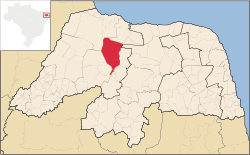 Location in Rio Grande do Norte state | |
 Assu Location in Brazil | |
| Coordinates: 5°34′37″S 36°54′32″W / 5.57694°S 36.90889°WCoordinates: 5°34′37″S 36°54′32″W / 5.57694°S 36.90889°W | |
| Country |
|
| Region | Northeast Region |
| State | Rio Grande do Norte |
| Area | |
| • Total | 1,303 km2 (503 sq mi) |
| Population (2015) | |
| • Total | 57,292 |
| • Density | 44/km2 (110/sq mi) |
| Time zone | BRT (UTC-3) |
Açu (or Assu) is a municipality (município) in the state of Rio Grande do Norte in Brazil. The population is 57,292 (2015 est.) in an area of 1303 km².[1]
The municipality contains the Açu National Forest, a 218 hectares (540 acres) sustainable use conservation unit that was originally established as a forest park in 1950.[2] The Barragem Armando Ribeiro Gonçalves, a reservoir on the Piranhas River, is partly located in the municipality.
References
- ↑ Instituto Brasileiro de Geografia e Estatística
- ↑ FLONA Açu (in Portuguese), ISA: Instituto Socioambiental, retrieved 2016-06-01
External links
This article is issued from Wikipedia - version of the 10/20/2016. The text is available under the Creative Commons Attribution/Share Alike but additional terms may apply for the media files.