Atkaracalar
| Atkaracalar | |
|---|---|
| Town | |
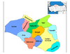 Location of Atkaracalar within Turkey. | |
 Atkaracalar Location of Atkaracalar within Turkey. | |
| Coordinates: 40°49′N 33°04′E / 40.817°N 33.067°E | |
| Country |
|
| Province | Çankırı |
| Government | |
| • Mayor | Rıfat Altuntop (AKP) |
| Area[1] | |
| • District | 363.29 km2 (140.27 sq mi) |
| Population (2012)[2] | |
| • Urban | 1,893 |
| • District | 4,675 |
| • District density | 13/km2 (33/sq mi) |
| Time zone | EET (UTC+2) |
| • Summer (DST) | EEST (UTC+3) |
| Postal code | 18xxx |
| Area code(s) | 0 |
| Licence plate | 18 |
Atkaracalar is a town and district of Çankırı Province in the Central Anatolia region of Turkey.
Atkaracalar is a typical Central Anatolian county, People are living in Atkaracalar are primarily agricultural with barley, wheat, beans. And animal husbandry is most commonly doing in the county.
References
- ↑ "Area of regions (including lakes), km²". Regional Statistics Database. Turkish Statistical Institute. 2002. Retrieved 2013-03-05.
- ↑ "Population of province/district centers and towns/villages by districts - 2012". Address Based Population Registration System (ABPRS) Database. Turkish Statistical Institute. Retrieved 2013-02-27.
Falling Rain Genomics, Inc. "Geographical information on Atkaracalar, Turkey". Retrieved 2008-03-13.
External links
- District governor's official website (Turkish)
- District municipality's official website (Turkish)
This article is issued from Wikipedia - version of the 12/21/2014. The text is available under the Creative Commons Attribution/Share Alike but additional terms may apply for the media files.