Bad Sankt Leonhard im Lavanttal
| Bad Sankt Leonhard im Lavanttal | ||
|---|---|---|
|
Old Town of Bad Sankt Leonhard | ||
| ||
 Bad Sankt Leonhard im Lavanttal Location within Austria | ||
| Coordinates: 46°58′N 14°48′E / 46.967°N 14.800°ECoordinates: 46°58′N 14°48′E / 46.967°N 14.800°E | ||
| Country | Austria | |
| State | Carinthia | |
| District | Wolfsberg | |
| Government | ||
| • Mayor | Simon Maier | |
| Area | ||
| • Total | 111.72 km2 (43.14 sq mi) | |
| Elevation | 721 m (2,365 ft) | |
| Population (1 January 2016)[1] | ||
| • Total | 4,412 | |
| • Density | 39/km2 (100/sq mi) | |
| Time zone | CET (UTC+1) | |
| • Summer (DST) | CEST (UTC+2) | |
| Postal code | 9462 | |
| Area code | 04250 | |
| Website | www.bad-st-leonhard-i-lav.at | |
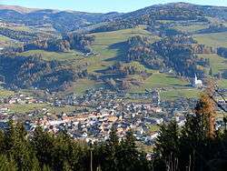

Bad Sankt Leonhard im Lavanttal (Slovene: Sveti Lenart v Labotu) is a town in the district of Wolfsberg in the Austrian state of Carinthia.
Geography
The municipality lies in the Lavant valley north of Wolfsberg.
References
| Wikimedia Commons has media related to Bad Sankt Leonhard. |
This article is issued from Wikipedia - version of the 11/25/2016. The text is available under the Creative Commons Attribution/Share Alike but additional terms may apply for the media files.