Bamfurlong, Greater Manchester
| Bamfurlong | |
%2C_Bamfurlong_(geograph_2818380).jpg) Lily Lane (A58), Bamfurlong |
|
 Bamfurlong |
|
| OS grid reference | SD596014 |
|---|---|
| Metropolitan borough | Wigan |
| Metropolitan county | Greater Manchester |
| Region | North West |
| Country | England |
| Sovereign state | United Kingdom |
| Post town | WIGAN |
| Postcode district | WN2 |
| Dialling code | 01942 |
| Police | Greater Manchester |
| Fire | Greater Manchester |
| Ambulance | North West |
| EU Parliament | North West England |
| UK Parliament | Makerfield |
|
|
Coordinates: 53°30′29″N 2°36′29″W / 53.508°N 2.608°W
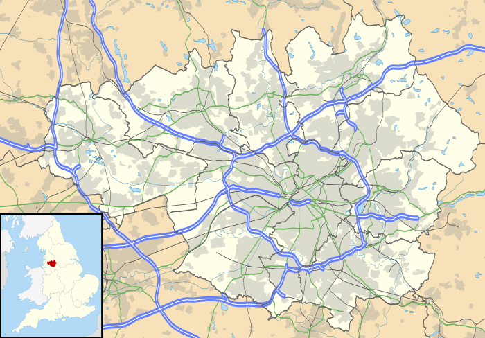
Bamfurlong is a small residential village in the Metropolitan Borough of Wigan, Greater Manchester.
Location
It lies approximately 5 miles south of Wigan town centre and 2 miles to the north of Ashton-in-Makerfield. Bamfurlong has a population of around 2,500 people.
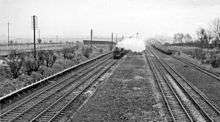
Remains of the station in 1962
Bamfurlong is within the ward of Abram.[1] For transport it is close to the M6 motorway. Bamfurlong railway station served the village from 1832 until closure in 1950.[2] The proposed High Speed 2 line will connect to the West Coast Main Line at the site of the closed station, allowing high-speed services to continue north to Wigan North Western, Carlisle, Edinburgh Waverley and Glasgow Central.
 |
Wigan | | ||
| |
||||
| ||||
| | ||||
| Ashton-in-Makerfield |
References
| Wikimedia Commons has media related to Bamfurlong, Greater Manchester. |
This article is issued from Wikipedia - version of the 1/29/2016. The text is available under the Creative Commons Attribution/Share Alike but additional terms may apply for the media files.