Barcaldine Airport
| Barcaldine Airport | |||||||||||||||
|---|---|---|---|---|---|---|---|---|---|---|---|---|---|---|---|
 | |||||||||||||||
| IATA: BCI – ICAO: YBAR | |||||||||||||||
| Summary | |||||||||||||||
| Airport type | Public | ||||||||||||||
| Operator | Barcaldine Regional Council | ||||||||||||||
| Location | Barcaldine, Queensland | ||||||||||||||
| Elevation AMSL | 880 ft / 268 m | ||||||||||||||
| Coordinates | 23°33′55″S 145°18′24″E / 23.56528°S 145.30667°ECoordinates: 23°33′55″S 145°18′24″E / 23.56528°S 145.30667°E | ||||||||||||||
| Map | |||||||||||||||
 YBAR Location in Queensland | |||||||||||||||
| Runways | |||||||||||||||
| |||||||||||||||
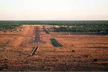
Barcaldine Airport (IATA: BCI, ICAO: YBAR) is an airport in Barcaldine, Queensland, Australia.
Airlines and destinations
| Airlines | Destinations |
|---|---|
| JETGO | Brisbane (charter) |
| QantasLink operated by Sunstate Airlines | Brisbane, Longreach |
See also
References
- ↑ YBAR – Barcaldine (PDF). AIP En Route Supplement from Airservices Australia, effective 10 November 2016, Aeronautical Chart Archived 25 March 2012 at the Wayback Machine.
This article is issued from Wikipedia - version of the 12/4/2016. The text is available under the Creative Commons Attribution/Share Alike but additional terms may apply for the media files.