Beresford Parish, New Brunswick
This article is about the parish. For the village, see Beresford, New Brunswick.
| Beresford | |
|---|---|
| Parish | |
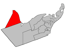 Location within Gloucester County, New Brunswick | |
| Coordinates: 47°42′54″N 65°53′15″W / 47.715°N 65.8875°W | |
| Country |
|
| Province |
|
| County | Gloucester |
| Established | 1814 |
| Area[1] | |
| • Land | 456.75 km2 (176.35 sq mi) |
| Population (2011)[1] | |
| • Total | 6,354 |
| • Density | 13.9/km2 (36/sq mi) |
| • Pop 2006-2011 |
|
| • Dwellings | 2,730 |
| Time zone | AST (UTC-4) |
| • Summer (DST) | ADT (UTC-3) |
Beresford is a Canadian parish in Gloucester County, New Brunswick.[2]
Delineation
Beresford Parish is defined in the Territorial Division Act[3] as being bounded:
- West by the County line; east by the Chaleur Bay and south by the easterly prolongation of the south line of Restigouche County.
Communities
Parish population total does not include incorporated municipalities (in bold):
|
|
|
Demographics
Population
| Canada census – Beresford Parish, New Brunswick community profile | |||
|---|---|---|---|
| 2011 | 2006 | 2001 | |
| Population: | 6,354 (+0.8% from 2006) | 6,301 (-4.8% from 2001) | 6,622 (-3.0% from 1996) |
| Land area: | 456.75 km2 (176.35 sq mi) | 455.93 km2 (176.04 sq mi) | 456.00 km2 (176.06 sq mi) |
| Population density: | 13.9/km2 (36/sq mi) | 13.8/km2 (36/sq mi) | 14.5/km2 (38/sq mi) |
| Median age: | 46.0 (M: 46.1, F: 46.0) | 42.4 (M: 42.6, F: 42.2) | 38.2 (M: 38.6, F: 37.8) |
| Total private dwellings: | 2,730 | 2,633 | 2,568 |
| Median household income: | $53,109 | $45,901 | $42,423 |
| References: 2011[4] 2006[5] 2001[6] | |||
| Historical Census Data - Beresford Parish, New Brunswick[7] | ||||||||||||||||||||||||||
|---|---|---|---|---|---|---|---|---|---|---|---|---|---|---|---|---|---|---|---|---|---|---|---|---|---|---|
|
|
| ||||||||||||||||||||||||
Language
| Canada Census Mother Tongue - Beresford Parish, New Brunswick[7] | ||||||||||||||||||
|---|---|---|---|---|---|---|---|---|---|---|---|---|---|---|---|---|---|---|
| Census | Total | French |
English |
French & English |
Other | |||||||||||||
| Year | Responses | Count | Trend | Pop % | Count | Trend | Pop % | Count | Trend | Pop % | Count | Trend | Pop % | |||||
| 2011 |
6,275 |
5,755 | |
91.71% | 435 | |
6.93% | 60 | |
0.96% | 25 | |
0.40% | |||||
| 2006 |
6,205 |
5,575 | |
89.85% | 475 | |
7.65% | 95 | |
1.53% | 60 | |
0.97% | |||||
| 2001 |
6,520 |
5,925 | |
90.87% | 500 | |
7.67% | 75 | |
1.15% | 20 | |
0.31% | |||||
| 1996 |
6,785 |
6,155 | n/a | 90.71% | 570 | n/a | 8.40% | 50 | n/a | 0.74% | 10 | n/a | 0.15% | |||||
Access Routes
Highways and numbered routes that run through the parish, including external routes that start or finish at the parish limits:[8]
|
|
|
See also
References
- 1 2 2011 Statistics Canada Census Profile: Beresford Parish, New Brunswick
- ↑ New Brunswick Provincial Archives - Beresford Parish
- ↑ "Territorial Division Act (R.S.N.B. 1973, c. T-3)". Government of New Brunswick website. Retrieved 17 August 2016.
- ↑ "2011 Community Profiles". Canada 2011 Census. Statistics Canada. July 5, 2013. Retrieved 2014-03-30.
- ↑ "2006 Community Profiles". Canada 2006 Census. Statistics Canada. March 30, 2011. Retrieved 2014-03-30.
- ↑ "2001 Community Profiles". Canada 2001 Census. Statistics Canada. February 17, 2012. Retrieved 2014-03-30.
- 1 2 Statistics Canada: 1996, 2001, 2006, 2011 census
- ↑ Atlantic Canada Back Road Atlas ISBN 978-1-55368-618-7 Page 7
 |
Chaleur Bay | | ||
| Durham Parish (Restigouche County) |
|
Nepisiguit Bay | ||
| ||||
| | ||||
| Bathurst Parish |
| Subdivisions | |
|---|---|
| Cities | |
| Counties | |
| |
Coordinates: 47°42′54″N 65°53′15″W / 47.71500°N 65.88750°W
This article is issued from Wikipedia - version of the 11/23/2016. The text is available under the Creative Commons Attribution/Share Alike but additional terms may apply for the media files.