Bjørnør
| Bjørnør herred | |
|---|---|
| Former Municipality | |
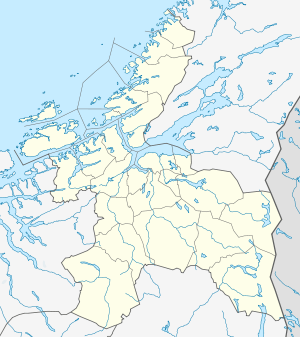 Bjørnør Location in Sør-Trøndelag | |
| Coordinates: 64°10′21″N 10°32′15″E / 64.17250°N 10.53750°ECoordinates: 64°10′21″N 10°32′15″E / 64.17250°N 10.53750°E | |
| Country | Norway |
| Region | Trøndelag |
| County | Sør-Trøndelag |
| District | Fosen |
| Time zone | CET (UTC+01:00) |
| • Summer (DST) | CEST (UTC+02:00) |
| ISO 3166 code | NO-1632 |
| Created as | Formannskapsdistrikt in 1838 |
| Split into | Roan, Stoksund, and Osen in 1892 |
Bjørnør is a former municipality in Sør-Trøndelag county, Norway. It encompassed the present-day municipalities of Roan and Osen, plus the Stoksund area in present-day Åfjord, all in the western part of the Fosen peninsula.[1] The municipality bordered Aafjord in the south and Nordre Trondhjem county to the north and west.
History
The municipality of Bjørnør was established on 1 January 1838 (see formannskapsdistrikt). On 1 June 1892, Bjørnør ceased to exist when it was split into three new municipalities: Osen (population: 1,575), Roan (population: 2,069), and Stoksund (population: 1,122).[2]
References
- ↑ Store norske leksikon. "Bjørnør – tidligere kommune" (in Norwegian). Retrieved 2010-12-31.
- ↑ Jukvam, Dag (1999). "Historisk oversikt over endringer i kommune- og fylkesinndelingen" (PDF) (in Norwegian). Statistisk sentralbyrå.
This article is issued from Wikipedia - version of the 4/29/2015. The text is available under the Creative Commons Attribution/Share Alike but additional terms may apply for the media files.