Blanchard, North Dakota
| Blanchard, North Dakota | |
|---|---|
| Census-designated place | |
|
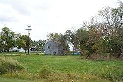
Blanchard residential street | |
 Blanchard, North Dakota Location within the state of North Dakota | |
| Coordinates: 47°20′35″N 097°13′23″W / 47.34306°N 97.22306°WCoordinates: 47°20′35″N 097°13′23″W / 47.34306°N 97.22306°W | |
| Country | United States |
| State | North Dakota |
| County | Traill |
| Area | |
| • Total | 0.26 sq mi (0.7 km2) |
| • Land | 0.26 sq mi (0.7 km2) |
| • Water | 0 sq mi (0 km2) |
| Elevation | 945 ft (288 m) |
| Population (2010)[1] | |
| • Total | 26 |
| • Density | 100/sq mi (39/km2) |
| Time zone | Central (CST) (UTC-6) |
| • Summer (DST) | CDT (UTC-5) |
| ZIP code | 58009 |
| Area code(s) | 701 |
| FIPS code | 38-07620[2] |
| GNIS feature ID | 2584337[3] |
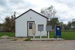
Blanchard post office
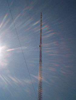
KVLY-TV mast seen close-up
Blanchard is a census-designated place in Blanchard Township, Traill County, North Dakota in the United States. The population was 26 at the 2010 census.[1]
Blanchard is near the North Dakota-Minnesota border, near the junction of North Dakota State Highway 18 and North Dakota State Highway 200.
The KVLY-TV mast, the tallest man-made structure in the western hemisphere, stands near Blanchard. The KXJB-TV mast, the fourth tallest man-made structure in the world, stands 6 miles (9.7 km) from Blanchard, near Galesburg.
References
- 1 2 "2010 Census Redistricting Data (Public Law 94-171) Summary File". American FactFinder. United States Census Bureau. Archived from the original on July 21, 2011. Retrieved May 2, 2011.
- ↑ "American FactFinder". United States Census Bureau. Archived from the original on 2013-09-11. Retrieved 2008-01-31.
- ↑ "US Board on Geographic Names". United States Geological Survey. 2007-10-25. Retrieved 2008-01-31.
External links
Municipalities and communities of Traill County, North Dakota, United States | ||
|---|---|---|
| Cities | 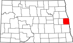 | |
| Townships |
| |
| CDPs | ||
| Unincorporated communities |
| |
| Footnotes | ‡This populated place also has portions in an adjacent county or counties | |
This article is issued from Wikipedia - version of the 11/8/2016. The text is available under the Creative Commons Attribution/Share Alike but additional terms may apply for the media files.