Bliha
| Bliha | |
|---|---|
 Bliha Falls | |
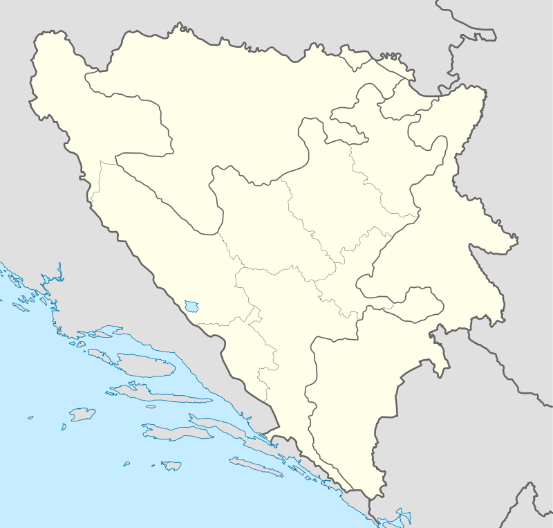 Bliha river in Bosnia and Herzegovina | |
| Bosanska Krajina | Sanski Most |
| Basin | |
| Main source |
Donji Lipnik ≈450 m (1,480 ft) 44°48′23″N 16°23′40″E / 44.806278°N 16.394323°E |
| River mouth |
Sana 154 m (505 ft) 44°46′49″N 16°39′56″E / 44.780162°N 16.665632°ECoordinates: 44°46′49″N 16°39′56″E / 44.780162°N 16.665632°E |
| Alt. difference | ≈300 m (980 ft) |
| River system | Black Sea |
| Physical characteristics | |
| Length | 24 km (15 mi) |
| Features | |
| Tributaries |
|
| Waterfalls | Bliha Falls |
The Bliha is a river in Bosnia and Herzegovina. It is a left tributary of the Sana river, located in region of Bosanska Krajina, on Sanski Most municipality territory and town vicinity.
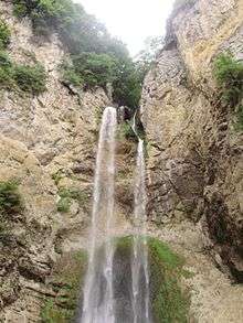
Bliha Falls
Main article: Bliha Falls
The Bliha Falls (Bosnian: Vodopad Blihe; or Bosnian: Slapovi Blihe), called by locals Blihin Skok (English: Bliha's Jump or English: Leap of Bliha), is a waterfall on the Bliha river located near Fajtovci, 14 kilometers west of Sanski Most, Bosnia and Herzegovina. The 56 meters high waterfall is designated a natural monument since 1965.[1][2]
See also
References
- ↑ "Sanski Most" (PDF) (in Bosnian). Government of Bosnia and Herzegovina. p. 2. Retrieved 15 July 2012.
- ↑ "Vodopad Bliha". European Environment Agency. Retrieved 15 July 2012.
| Wikimedia Commons has media related to Bliha Waterfall. |
This article is issued from Wikipedia - version of the 8/18/2016. The text is available under the Creative Commons Attribution/Share Alike but additional terms may apply for the media files.