Bonneville-la-Louvet
| Bonneville-la-Louvet | |
|---|---|
 Bonneville-la-Louvet | |
|
Location within Normandy region 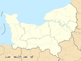 Bonneville-la-Louvet | |
| Coordinates: 49°16′32″N 0°20′24″E / 49.2756°N 0.34°ECoordinates: 49°16′32″N 0°20′24″E / 49.2756°N 0.34°E | |
| Country | France |
| Region | Normandy |
| Department | Calvados |
| Arrondissement | Lisieux |
| Canton | Blangy-le-Château |
| Intercommunality | Blangy Pont-l'Évêque |
| Government | |
| • Mayor (2008–2014) | Hubert Courseaux |
| Area1 | 20.75 km2 (8.01 sq mi) |
| Population (2008)2 | 786 |
| • Density | 38/km2 (98/sq mi) |
| Time zone | CET (UTC+1) |
| • Summer (DST) | CEST (UTC+2) |
| INSEE/Postal code | 14085 / 14130 |
| Elevation |
39–166 m (128–545 ft) (avg. 25 m or 82 ft) |
|
1 French Land Register data, which excludes lakes, ponds, glaciers > 1 km² (0.386 sq mi or 247 acres) and river estuaries. 2 Population without double counting: residents of multiple communes (e.g., students and military personnel) only counted once. | |
Bonneville-la-Louvet is a commune in the Calvados department in the Normandy region in northwestern France.
Geography
The commune is located in the heart of the Pays d'Auge, 12 km east of Pont-l'Évêque and 18 km southeast of Honfleur.
Population
| Historical population | ||
|---|---|---|
| Year | Pop. | ±% |
| 1962 | 776 | — |
| 1968 | 677 | −12.8% |
| 1975 | 586 | −13.4% |
| 1982 | 613 | +4.6% |
| 1990 | 673 | +9.8% |
| 1999 | 667 | −0.9% |
| 2008 | 786 | +17.8% |
See also
References
External links
| Wikimedia Commons has media related to Bonneville-la-Louvet. |
This article is issued from Wikipedia - version of the 3/16/2016. The text is available under the Creative Commons Attribution/Share Alike but additional terms may apply for the media files.