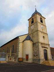
Bréhain
For other uses, see Bréhain-la-Ville and Château-Bréhain.
| Bréhain | ||
|---|---|---|
 | ||
| ||
 Bréhain | ||
|
Location within Grand Est region 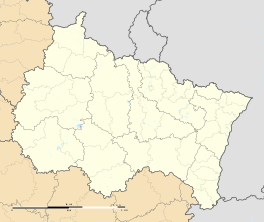 Bréhain | ||
| Coordinates: 48°54′38″N 6°32′19″E / 48.9106°N 6.5386°ECoordinates: 48°54′38″N 6°32′19″E / 48.9106°N 6.5386°E | ||
| Country | France | |
| Region | Grand Est | |
| Department | Moselle | |
| Arrondissement | Sarrebourg-Château-Salins | |
| Canton | Le Saulnois | |
| Intercommunality | Saulnois | |
| Government | ||
| • Mayor (2008–2014) | Roland Butlingaire | |
| Area1 | 3.59 km2 (1.39 sq mi) | |
| Population (2009)2 | 101 | |
| • Density | 28/km2 (73/sq mi) | |
| Time zone | CET (UTC+1) | |
| • Summer (DST) | CEST (UTC+2) | |
| INSEE/Postal code | 57107 / 57340 | |
| Elevation |
244–314 m (801–1,030 ft) (avg. 250 m or 820 ft) | |
|
1 French Land Register data, which excludes lakes, ponds, glaciers > 1 km² (0.386 sq mi or 247 acres) and river estuaries. 2 Population without double counting: residents of multiple communes (e.g., students and military personnel) only counted once. | ||
.svg.png)
Bréhain is a commune in the Moselle department in Grand Est in northeastern France.
Population
| Historical population | ||
|---|---|---|
| Year | Pop. | ±% |
| 1702 | 23 | — |
| 1833 | 345 | +1400.0% |
| 1942 | 2 | −99.4% |
| 1944 | 6 | +200.0% |
| 1962 | 101 | +1583.3% |
| 1968 | 101 | +0.0% |
| 1975 | 106 | +5.0% |
| 1982 | 80 | −24.5% |
| 1990 | 72 | −10.0% |
| 1999 | 75 | +4.2% |
| 2006 | 93 | +24.0% |
| 2009 | 101 | +8.6% |
See also
References
This article is issued from Wikipedia - version of the 11/17/2016. The text is available under the Creative Commons Attribution/Share Alike but additional terms may apply for the media files.