Brightwalton Green
| Brightwalton Green | |
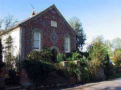 Wesleyan Chapel |
|
 Brightwalton Green |
|
| OS grid reference | SU427784 |
|---|---|
| Unitary authority | West Berkshire |
| Ceremonial county | Berkshire |
| Region | South East |
| Country | England |
| Sovereign state | United Kingdom |
| Post town | Newbury |
| Postcode district | RG20 |
| Dialling code | 01488 |
| Police | Thames Valley |
| Fire | Royal Berkshire |
| Ambulance | South Central |
| EU Parliament | South East England |
| UK Parliament | Berkshire |
Coordinates: 51°30′11″N 1°23′12″W / 51.502953°N 1.386667°W
Brightwalton Green is a hamlet in the civil parish of Brightwalton (where the 2011 Census population was included) in the county of Berkshire, England.[1][2] The settlement lies near to the A338 road, and is situated approximately 8 miles (13 km) north-west of Newbury.
References
- ↑ Ordnance Survey: Landranger map sheet 174 Newbury & Wantage (Hungerford & Didcot) (Map). Ordnance Survey. 2014. ISBN 9780319228739.
- ↑ "Ordnance Survey: 1:50,000 Scale Gazetteer" (csv (download)). www.ordnancesurvey.co.uk. Ordnance Survey. 1 January 2016. Retrieved 30 January 2016.
This article is issued from Wikipedia - version of the 12/2/2016. The text is available under the Creative Commons Attribution/Share Alike but additional terms may apply for the media files.