Burntheath
| Burntheath | |
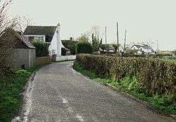 Top Lane, Burntheath. |
|
 Burntheath |
|
| Population | 30 |
|---|---|
| OS grid reference | SK243313 |
| District | South Derbyshire |
| Shire county | Derbyshire |
| Region | East Midlands |
| Country | England |
| Sovereign state | United Kingdom |
| Post town | DERBY |
| Postcode district | DE65 |
| Police | Derbyshire |
| Fire | Derbyshire |
| Ambulance | East Midlands |
| EU Parliament | East Midlands |
|
|
Coordinates: 52°52′44″N 1°38′20″W / 52.879°N 1.639°W
Burntheath is a hamlet in Derbyshire, England. It is located 1 mile north of Hilton, and adjacent to the A50 road.
This article is issued from Wikipedia - version of the 1/23/2016. The text is available under the Creative Commons Attribution/Share Alike but additional terms may apply for the media files.