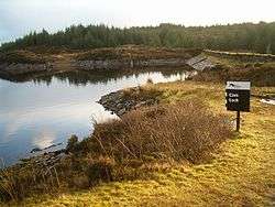
Cam Loch
Not to be confused with Cam Loch in Assynt.
National grid reference NR82308780
| Cam Loch | |
|---|---|
 | |
| Location | North Knapdale, Scotland |
| Coordinates | 56°01′59″N 5°29′45″W / 56.0330°N 5.4958°WCoordinates: 56°01′59″N 5°29′45″W / 56.0330°N 5.4958°W |
| Type | Reservoir |
| Basin countries | Scotland, United Kingdom |
| Surface area | 284960 sq. metres |
| Water volume | 1068000 cubic metres |
Cam Loch (the Crooked Loch) is one of a number of water supply sources for the Crinan Canal. The impounding reservoir lies to the south of the canal and about 3 kilometres west of Lochgilphead. It has an earthwork dam 8.5 metres high, with records showing that construction was before 1860.
See also
Sources
This article is issued from Wikipedia - version of the 11/13/2016. The text is available under the Creative Commons Attribution/Share Alike but additional terms may apply for the media files.