Champagné-Saint-Hilaire
| Champagné-Saint-Hilaire | |
|---|---|
|
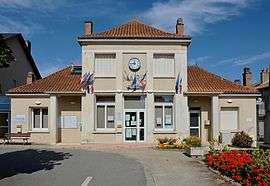
The town hall in Champagné-Saint-Hilaire | |
 Champagné-Saint-Hilaire | |
|
Location within Nouvelle-Aquitaine region  Champagné-Saint-Hilaire | |
| Coordinates: 46°19′14″N 0°19′30″E / 46.3206°N 0.325°ECoordinates: 46°19′14″N 0°19′30″E / 46.3206°N 0.325°E | |
| Country | France |
| Region | Nouvelle-Aquitaine |
| Department | Vienne |
| Arrondissement | Montmorillon |
| Canton | Gençay |
| Intercommunality | Pays Gencéen |
| Government | |
| • Mayor (2008–2014) | Gilles Bossebœuf |
| Area1 | 46.36 km2 (17.90 sq mi) |
| Population (2006)2 | 928 |
| • Density | 20/km2 (52/sq mi) |
| Time zone | CET (UTC+1) |
| • Summer (DST) | CEST (UTC+2) |
| INSEE/Postal code | 86052 / 86160 |
| Elevation |
99–195 m (325–640 ft) (avg. 194 m or 636 ft) |
|
1 French Land Register data, which excludes lakes, ponds, glaciers > 1 km² (0.386 sq mi or 247 acres) and river estuaries. 2 Population without double counting: residents of multiple communes (e.g., students and military personnel) only counted once. | |
Champagné-Saint-Hilaire is a commune in the Vienne department in the Nouvelle-Aquitaine region in western France.
Champagné-Saint-Hilaire is located in the geographical area known as the seuil du Poitou. It is also the highest commune in the vicinity.
See also
References
| Wikimedia Commons has media related to Champagné-Saint-Hilaire. |
This article is issued from Wikipedia - version of the 11/11/2016. The text is available under the Creative Commons Attribution/Share Alike but additional terms may apply for the media files.