Champdor
| Champdor | ||
|---|---|---|
 | ||
| ||
 Champdor | ||
|
Location within Auvergne-Rhône-Alpes region  Champdor | ||
| Coordinates: 46°01′05″N 5°35′52″E / 46.0181°N 5.5978°ECoordinates: 46°01′05″N 5°35′52″E / 46.0181°N 5.5978°E | ||
| Country | France | |
| Region | Auvergne-Rhône-Alpes | |
| Department | Ain | |
| Arrondissement | Belley | |
| Canton | Hauteville-Lompnes | |
| Intercommunality | Plateau d'Hauteville | |
| Government | ||
| • Mayor (2008–2014) | Michel Rivat | |
| Area1 | 17.37 km2 (6.71 sq mi) | |
| Population (2008)2 | 450 | |
| • Density | 26/km2 (67/sq mi) | |
| Time zone | CET (UTC+1) | |
| • Summer (DST) | CEST (UTC+2) | |
| INSEE/Postal code | 01080 / 01110 | |
| Elevation |
798–1,183 m (2,618–3,881 ft) (avg. 826 m or 2,710 ft) | |
|
1 French Land Register data, which excludes lakes, ponds, glaciers > 1 km² (0.386 sq mi or 247 acres) and river estuaries. 2 Population without double counting: residents of multiple communes (e.g., students and military personnel) only counted once. | ||
.svg.png)
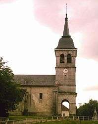
Champdor is a former commune in the Ain department in eastern France. On 1 January 2016, it was merged into the new commune Champdor-Corcelles.[1]
Geography
The river Albarine forms part of the commune's northwestern border, then flows south through the commune.
Population
| Historical population | ||
|---|---|---|
| Year | Pop. | ±% |
| 1793 | 637 | — |
| 1800 | 603 | −5.3% |
| 1806 | 616 | +2.2% |
| 1821 | 633 | +2.8% |
| 1831 | 717 | +13.3% |
| 1836 | 658 | −8.2% |
| 1841 | 683 | +3.8% |
| 1846 | 737 | +7.9% |
| 1851 | 782 | +6.1% |
| 1856 | 678 | −13.3% |
| 1861 | 675 | −0.4% |
| 1866 | 631 | −6.5% |
| 1872 | 575 | −8.9% |
| 1876 | 571 | −0.7% |
| 1881 | 582 | +1.9% |
| 1886 | 560 | −3.8% |
| 1891 | 541 | −3.4% |
| 1896 | 559 | +3.3% |
| 1901 | 538 | −3.8% |
| 1906 | 472 | −12.3% |
| 1911 | 457 | −3.2% |
| 1921 | 400 | −12.5% |
| 1926 | 394 | −1.5% |
| 1931 | 367 | −6.9% |
| 1936 | 363 | −1.1% |
| 1946 | 342 | −5.8% |
| 1954 | 358 | +4.7% |
| 1962 | 327 | −8.7% |
| 1968 | 362 | +10.7% |
| 1975 | 365 | +0.8% |
| 1982 | 428 | +17.3% |
| 1990 | 459 | +7.2% |
| 1999 | 425 | −7.4% |
| 2008 | 450 | +5.9% |
See also
References
- ↑ Arrêté préfectoral 27 November 2015 (French)
| Wikimedia Commons has media related to Champdor. |
This article is issued from Wikipedia - version of the 2/8/2016. The text is available under the Creative Commons Attribution/Share Alike but additional terms may apply for the media files.