Chatham Municipal Airport
| Chatham Municipal Airport | |||||||||||
|---|---|---|---|---|---|---|---|---|---|---|---|
 | |||||||||||
|
IATA: none – ICAO: KCQX – FAA LID: CQX – WMO: 74494 | |||||||||||
| Summary | |||||||||||
| Airport type | Public | ||||||||||
| Owner | Town of Chatham | ||||||||||
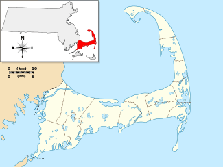
| Location | Chatham, Massachusetts | ||||||||||
| Elevation AMSL | 68 ft / 21 m | ||||||||||
| Coordinates | 41°41′18″N 069°59′22″W / 41.68833°N 69.98944°W | ||||||||||
| Map | |||||||||||
 CQX | |||||||||||
| Runways | |||||||||||
| |||||||||||
| Statistics (2006) | |||||||||||
| |||||||||||
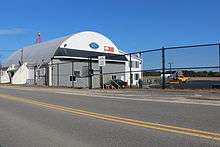
Chatham Municipal Airport (ICAO: KCQX, FAA LID: CQX) is a public airport located two miles (3 km) northwest of the central business district of Chatham, a town in Barnstable County, Massachusetts, United States. The airport is owned by the Town of Chatham.[1] It has a full-service FBO (Cape Cod Flying Circus) and maintenance facility in their main building (Stick N Rudder Aero Maintenance). The flight school and sightseeing is operated by Cape Aerial Tours. There is also a restaurant Hangar B, a small eatery upstairs, serving breakfast and lunch.
Facilities and aircraft
Chatham Municipal Airport covers an area of 105 acres (42 ha) which contains one paved runway (6/24) measuring 3,001 x 100 ft (915 x 30 m).[1]
For 12-month period ending January 1, 2007, the airport had 25,530 aircraft operations, an average of 69 per day: 99% general aviation, 1% air taxi and <1% military. There are 47 aircraft based at this airport: 85% single engine, 11% multi-engine and 4% helicopters.[1]
References
External links
| Wikimedia Commons has media related to Chatham Municipal Airport. |
- CQX: Chatham Municipal Airport
- Resources for this airport:
- FAA airport information for CQX
- AirNav airport information for KCQX
- ASN accident history for CQX
- FlightAware airport information and live flight tracker
- NOAA/NWS latest weather observations
- SkyVector aeronautical chart, Terminal Procedures