Chellala District
| Chellala District دائرة شلالة | |
|---|---|
| District | |
 Map of Algeria highlighting El Bayadh Province | |
| Country |
|
| Province | El Bayadh |
| District seat | Chellala |
| Area | |
| • Total | 3,164 km2 (1,222 sq mi) |
| Population (2005) | |
| • Total | 5,883 |
| • Density | 1.9/km2 (4.8/sq mi) |
| Time zone | CET (UTC+01) |
| Municipalities | 2 |
Chellala is a district in El Bayadh Province, Algeria. It was named after its capital, Chellala.
Municipalities
The district is further divided into 2 municipalities:
| Chellala District | 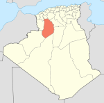 | |
|---|---|---|
| Brézina District | ||
| Rogassa District | ||
| El Abiodh Sidi Cheikh District |
| |
| Boualem District |
| |
| Bougtob District |
| |
| El Bayadh District | ||
| Boussemghoun District | ||
Coordinates: 33°01′59″N 0°03′20″E / 33.0331°N 0.0556°E
This article is issued from Wikipedia - version of the 7/18/2016. The text is available under the Creative Commons Attribution/Share Alike but additional terms may apply for the media files.