Chetwode Islands
 Chetwode Islands, Marlborough Sounds | |
| Geography | |
|---|---|
| Location | Marlborough Region |
| Coordinates | 40°54′S 174°04′E / 40.9°S 174.07°ECoordinates: 40°54′S 174°04′E / 40.9°S 174.07°E |
| Total islands | 4 |
| Major islands | 2 |
| Area | 2.5 km2 (0.97 sq mi) |
| Length | 5 km (3.1 mi) |
| Width | 1 km (0.6 mi) |
| Highest elevation | 247 m (810 ft) |
| Administration | |
| Demographics | |
| Population | 0 |
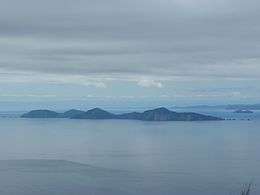
The Chetwode Islands are a group of islands near the Marlborough Sounds along the northern coast of the South Island of New Zealand.
The group consists of Nukuwaiata Island (to the South) (247 m or 810 ft) & Te Kakaho Island (179 m or 587 ft) to the North, and is named after Lieutenant Chetwode, acting commander of the Cruizer class brig-sloop, HMS Pelorus in 1838.
See also
References
External links
- Nukuwaiata / Inner Chetwode Island – 1936 and 2011 – In the footsteps of Edgar Stead
- Nukuwaiata (Inner Chetwode Island) birds and lizards
This article is issued from Wikipedia - version of the 11/21/2016. The text is available under the Creative Commons Attribution/Share Alike but additional terms may apply for the media files.