Chuyer
| Chuyer | |
|---|---|
|
A general view of Chuyer | |
 Chuyer | |
|
Location within Auvergne-Rhône-Alpes region  Chuyer | |
| Coordinates: 45°27′29″N 4°41′40″E / 45.4581°N 4.6944°ECoordinates: 45°27′29″N 4°41′40″E / 45.4581°N 4.6944°E | |
| Country | France |
| Region | Auvergne-Rhône-Alpes |
| Department | Loire |
| Arrondissement | Saint-Étienne |
| Canton | Pélussin |
| Intercommunality | Communauté de communes du Pilat rhodanien |
| Government | |
| • Mayor (2008–2014) | Gilles Chavas |
| Area1 | 12.06 km2 (4.66 sq mi) |
| Population (1999)2 | 587 |
| • Density | 49/km2 (130/sq mi) |
| Time zone | CET (UTC+1) |
| • Summer (DST) | CEST (UTC+2) |
| INSEE/Postal code | 42064 / 42410 |
| Elevation |
319–880 m (1,047–2,887 ft) (avg. 475 m or 1,558 ft) |
|
1 French Land Register data, which excludes lakes, ponds, glaciers > 1 km² (0.386 sq mi or 247 acres) and river estuaries. 2 Population without double counting: residents of multiple communes (e.g., students and military personnel) only counted once. | |
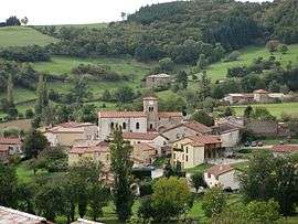
Chuyer is a commune in the Loire department in central France.
See also
| Wikimedia Commons has media related to Chuyer. |
This article is issued from Wikipedia - version of the 2/12/2016. The text is available under the Creative Commons Attribution/Share Alike but additional terms may apply for the media files.