City of Subiaco
This article is about a local government area. For the suburb, see Subiaco, Western Australia.
| City of Subiaco Western Australia | |||||||||||||
|---|---|---|---|---|---|---|---|---|---|---|---|---|---|
 | |||||||||||||
| Population | 19,693 (2013 est)[1] | ||||||||||||
| • Density | 2,340/km2 (6,100/sq mi) | ||||||||||||
| Established | 1896 | ||||||||||||
| Area | 7.0 km2 (2.7 sq mi) | ||||||||||||
| Mayor | Heather Henderson | ||||||||||||
| Council seat | Subiaco | ||||||||||||
| Region | West Metropolitan Perth | ||||||||||||
| State electorate(s) | Nedlands | ||||||||||||
| Federal Division(s) | Curtin | ||||||||||||
 | |||||||||||||
| Website | City of Subiaco | ||||||||||||
| |||||||||||||
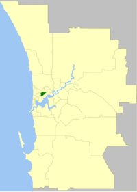
City of Subiaco is a local government area of Western Australia. It covers an area of approximately 7 km² in inner western metropolitan Perth, the capital of Western Australia and lies about 3 km west of the Perth CBD.
History
The Subiaco Municipality was gazetted in 1896, and was proclaimed a city on 1 March 1952.
On 1 July 2016 the area south of Aberdare Road was transferred to the City of Perth.[2]
Wards
The town is divided into 4 wards, each of three councillors. The mayor is directly elected.
- North Ward
- South Ward
- Central Ward
- East Ward
Suburbs
* These localities are only partially contained within the LGA boundary.
Population
| Year | Population |
|---|---|
| 1903 | 4,702 |
| 1911 | 8,926 |
| 1921 | 13,647 |
| 1933 | 16,809 |
| 1947 | 18,789 |
| 1954 | 17,642 |
| 1961 | 16,033 |
| 1966 | 16,621 |
| 1971 | 17,119 |
| 1976 | 15,271 |
| 1981 | 14,139 |
| 1986 | 14,826 |
| 1991 | 14,971 |
| 1996 | 14,804 |
| 2001 | 15,189 |
| 2006 | 16,380 |
| 2011 | 17,574 |
See also
- AmpFest, Youth and music festival overseen by the City of Subiaco
References
- ↑ "3218.0 Regional Population Growth, Australia. Table 5. Estimated Resident Population, Local Government Areas, Western Australia". 3 April 2014. Retrieved 11 September 2014.
- ↑ "Ward areas". City of Subiaco. Retrieved 28 August 2016.
External links
Coordinates: 31°56′56″S 115°49′37″E / 31.949°S 115.827°E
This article is issued from Wikipedia - version of the 8/28/2016. The text is available under the Creative Commons Attribution/Share Alike but additional terms may apply for the media files.