Congé-sur-Orne
| Congé-sur-Orne | |
|---|---|
|
View of the road to Dangeul | |
 Congé-sur-Orne | |
|
Location within Pays de la Loire region  Congé-sur-Orne | |
| Coordinates: 48°12′00″N 0°15′13″E / 48.2°N 0.2536°ECoordinates: 48°12′00″N 0°15′13″E / 48.2°N 0.2536°E | |
| Country | France |
| Region | Pays de la Loire |
| Department | Sarthe |
| Arrondissement | Mamers |
| Canton | Marolles-les-Braults |
| Intercommunality | Communauté de communes du Pays Marollais |
| Government | |
| • Mayor (2008–2014) | Jean-Michel Bougard |
| Area1 | 11.2 km2 (4.3 sq mi) |
| Population (2006)2 | 296 |
| • Density | 26/km2 (68/sq mi) |
| Time zone | CET (UTC+1) |
| • Summer (DST) | CEST (UTC+2) |
| INSEE/Postal code | 72088 / 72290 |
| Elevation | 53–73 m (174–240 ft) |
|
1 French Land Register data, which excludes lakes, ponds, glaciers > 1 km² (0.386 sq mi or 247 acres) and river estuaries. 2 Population without double counting: residents of multiple communes (e.g., students and military personnel) only counted once. | |
Congé-sur-Orne is a commune in the Sarthe department in the Pays de la Loire region in north-western France.
Its inhabitants are called 'Congéennes' and 'Congéens'; most of its population resides in the village, locally called le bourg; the rest is disseminated in hamlets and in isolated farms.
See also
References
Pictures
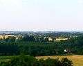 Congé-sur-Orne viewed from the hillsides of Ballon
 Congé-sur-Orne from the road of Dangeul
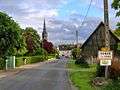 Entering the 'bourg.'
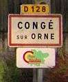
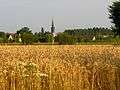 Congé-sur-Orne from the road of Dangeul
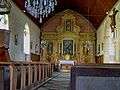 The church
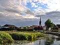 The Orne river
| Wikimedia Commons has media related to Congé-sur-Orne. |
This article is issued from Wikipedia - version of the 7/13/2016. The text is available under the Creative Commons Attribution/Share Alike but additional terms may apply for the media files.