Courtefontaine, Jura
| Courtefontaine | |
|---|---|
 | |
 Courtefontaine | |
|
Location within Bourgogne-Franche-Comté region  Courtefontaine | |
| Coordinates: 47°07′48″N 5°48′18″E / 47.13°N 5.805°ECoordinates: 47°07′48″N 5°48′18″E / 47.13°N 5.805°E | |
| Country | France |
| Region | Bourgogne-Franche-Comté |
| Department | Jura |
| Arrondissement | Dole |
| Canton | Dampierre |
| Government | |
| • Mayor (2014–2020) | Jean-Noël Arnoult |
| Area1 | 13.64 km2 (5.27 sq mi) |
| Population (2012)2 | 227 |
| • Density | 17/km2 (43/sq mi) |
| Time zone | CET (UTC+1) |
| • Summer (DST) | CEST (UTC+2) |
| INSEE/Postal code | 39172 / 39700 |
| Elevation | 225–306 m (738–1,004 ft) |
|
1 French Land Register data, which excludes lakes, ponds, glaciers > 1 km² (0.386 sq mi or 247 acres) and river estuaries. 2 Population without double counting: residents of multiple communes (e.g., students and military personnel) only counted once. | |
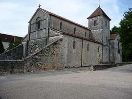
Courtefontaine is a commune in the Jura department in Franche-Comté in eastern France.
Population
| Historical population | ||
|---|---|---|
| Year | Pop. | ±% |
| 1793 | 288 | — |
| 1806 | 268 | −6.9% |
| 1821 | 322 | +20.1% |
| 1831 | 335 | +4.0% |
| 1841 | 395 | +17.9% |
| 1851 | 399 | +1.0% |
| 1861 | 292 | −26.8% |
| 1872 | 263 | −9.9% |
| 1881 | 338 | +28.5% |
| 1891 | 277 | −18.0% |
| 1901 | 303 | +9.4% |
| 1911 | 250 | −17.5% |
| 1921 | 274 | +9.6% |
| 1931 | 135 | −50.7% |
| 1946 | 123 | −8.9% |
| 1954 | 133 | +8.1% |
| 1962 | 85 | −36.1% |
| 1968 | 106 | +24.7% |
| 1975 | 119 | +12.3% |
| 1982 | 138 | +16.0% |
| 1990 | 185 | +34.1% |
| 1999 | 178 | −3.8% |
| 2006 | 204 | +14.6% |
| 2012 | 227 | +11.3% |
See also
References
| Wikimedia Commons has media related to Courtefontaine (Jura). |
This article is issued from Wikipedia - version of the 5/18/2015. The text is available under the Creative Commons Attribution/Share Alike but additional terms may apply for the media files.