Cowgate, Cumbria
| Cowgate | |
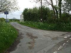 Minor road junction at Cowgate. |
|
 Cowgate |
|
| OS grid reference | NY092478 |
|---|---|
| Civil parish | Holme St. Cuthbert |
| District | Allerdale |
| Shire county | Cumbria |
| Region | North West |
| Country | England |
| Sovereign state | United Kingdom |
| Post town | WIGTON |
| Postcode district | CA7 |
| Dialling code | 01900 |
| Police | Cumbria |
| Fire | Cumbria |
| Ambulance | North West |
| EU Parliament | North West England |
| UK Parliament | Workington |
Coordinates: 54°49′01″N 3°24′43″W / 54.817°N 3.412°W
Cowgate is a small hamlet in the civil parish of Holme St. Cuthbert[1] in Cumbria, United Kingdom. It is situated approximately a quarter-of-a-mile south-west of Newtown, one mile north-west of the hamlet of Holme St. Cuthbert, and one-and-a-half miles north-east of Mawbray. Other nearby settlements include Goodyhills, one-and-a-quarter miles to the south-east, Hailforth, one-and-three-quarter miles to the south-east, and Beckfoot, one-and-a-half miles to the north. Carlisle, Cumbria's county town, is approximately twenty-four-and-a-half miles to the north-east.[2]
History and etymology
The name Cowgate is derived from the Old English cu-gate, meaning a "cow pasture". Recorded variant spellings include Cowyate, Cowyeat, and Cowyeate.[3]
References
| Wikimedia Commons has media related to Cowgate, Cumbria. |
- ↑ "Old Cumbria Gazetteer - Cowgate". Retrieved 27 July 2015.
- ↑ "Google Maps - Cowgate". Retrieved 27 July 2015.
- ↑ Holme St. Cuthbert History Group (2004). Plain People: Bygone Times on the Solway Plain. ISBN 0954882318.