D M Stevenson Ranch Airport
| D M Stevenson Ranch Airport | |||||||||||
|---|---|---|---|---|---|---|---|---|---|---|---|
| IATA: none – ICAO: none – FAA LID: OR30 | |||||||||||
| Summary | |||||||||||
| Airport type | PR | ||||||||||
| Owner | D M Stevenson Ranch | ||||||||||
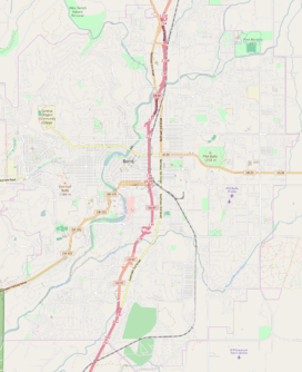
| Location | Bend, Oregon | ||||||||||
| Elevation AMSL | 3,800 ft / 1,158 m | ||||||||||
| Coordinates | 44°00′11.42″N 121°16′19.10″W / 44.0031722°N 121.2719722°W | ||||||||||
| Map | |||||||||||
 D M Stevenson Ranch Airport | |||||||||||
| Runways | |||||||||||
| |||||||||||
D M Stevenson Ranch Airport (FAA LID: OR30) is a private Airport located 5 miles southeast of Bend in Deschutes County, Oregon, USA.
External links
- Resources for this airport:
- FAA airport information for OR30
- AirNav airport information for OR30
- FlightAware airport information and live flight tracker
- SkyVector aeronautical chart for OR30
This article is issued from Wikipedia - version of the 4/14/2016. The text is available under the Creative Commons Attribution/Share Alike but additional terms may apply for the media files.