Daill Loch
National grid reference NR81619016
| Daill Loch | |
|---|---|
 | |
| Location | Knapdale, Scotland |
| Coordinates | 56°03′08″N 5°30′45″W / 56.0523°N 5.5125°WCoordinates: 56°03′08″N 5°30′45″W / 56.0523°N 5.5125°W |
| Type | Reservoir |
| Primary outflows | Dunadry Burn |
| Basin countries | Scotland, United Kingdom |
| Surface area | 123475 sq. metres |
| Surface elevation | 155 metres |
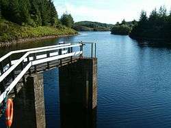
Daill Loch is an impounding reservoir located 5 kilometres west north west of Lochgilphead and 1.5 kilometres south of the Crinan Canal. It is one of a number of lochs supplying water to the canal. The earthen dam is 8.1 metres high and was completed in 1930.
See also
Sources
This article is issued from Wikipedia - version of the 10/1/2012. The text is available under the Creative Commons Attribution/Share Alike but additional terms may apply for the media files.