Dharbandora
| Dharbandora | |
|---|---|
| Taluka | |
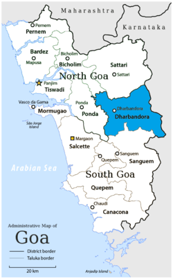 Location of Dharbandora in South Goa district in Goa | |
| Coordinates: 15°23′07″N 74°07′05″E / 15.385259°N 74.117948°ECoordinates: 15°23′07″N 74°07′05″E / 15.385259°N 74.117948°E | |
| Country |
|
| State | Goa |
| District | South Goa district |
| Independence from Sanguem | 4 April 2012 |
| Founded by | Government of Goa |
| Named for | Town of Dharbandora |
| Headquarters | Dharbandora |
| Major villages |
List
|
| Government | |
| • Mamlatdar | Mr. Satish R. Prabhu |
| • Lok Sabha constituency | - |
| • Assembly constituency | - |
| • MLA | - |
| Population (2012) | |
| • Taluka | 30,000 to 40,000 |
| • Urban | 20% |
| Demographics | |
| • Literacy rate | 67% |
| • Sex ratio | 840 |
| Rain | Average of 500 mm to 750 mm |
| Website |
goa |
Dharbandora is a taluka of Goa, India. It came into existence as a part of the South Goa district on 4 April 2012.[1] Five panchayats, Dharbandora, Kirlapal-Dabhal, Collem, Mollem and Sancorda from the Sanguem taluka were incorporated into the new taluka. The taluka at present has a population of 30,000 to 40,000 people. [2]
Ganjem and Usgao from Ponda taluka did not added to this tulka due to oppose, and the rest were from Sanguem taluka.[2]
 |
Ponda taluk | Satari taluk | Joida taluk | |
| Ponda taluk | |
Joida taluk | ||
| ||||
| | ||||
| Ponda taluk | Sanguem taluk | Joida taluk |
References
- ↑ "Govt issues notification for Dharbandora taluka". The Navhind Times. 19 March 2011. Archived from the original on 29 April 2013.
- 1 2 Kaisuvker, Suraj (24 March 2011). "New Dharbandora taluka from April 4". The Times of India.
.
This article is issued from Wikipedia - version of the 9/14/2016. The text is available under the Creative Commons Attribution/Share Alike but additional terms may apply for the media files.