Dinkelland
| Dinkelland | |||
|---|---|---|---|
| Municipality | |||
|
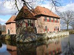
Castle in Dinkelland | |||
| |||
.svg.png) Location in Overijssel | |||
| Coordinates: 52°22′N 7°0′E / 52.367°N 7.000°ECoordinates: 52°22′N 7°0′E / 52.367°N 7.000°E | |||
| Country | Netherlands | ||
| Province | Overijssel | ||
| Government[1] | |||
| • Body | Municipal council | ||
| • Mayor | Roel Cazemier (VVD) | ||
| Area[2] | |||
| • Total | 176.82 km2 (68.27 sq mi) | ||
| • Land | 175.76 km2 (67.86 sq mi) | ||
| • Water | 1.06 km2 (0.41 sq mi) | ||
| Elevation[3] | 26 m (85 ft) | ||
| Population (May 2014)[4] | |||
| • Total | 25,950 | ||
| • Density | 148/km2 (380/sq mi) | ||
| Time zone | CET (UTC+1) | ||
| • Summer (DST) | CEST (UTC+2) | ||
| Postcode | Parts of 7500 and 7600 ranges | ||
| Area code | 0541, 074 | ||
| Website |
www | ||

Dinkelland (![]() pronunciation ) is a municipality in the eastern Netherlands. For a short time it was known as Denekamp (one of its component towns) until it was renamed in 2002.
pronunciation ) is a municipality in the eastern Netherlands. For a short time it was known as Denekamp (one of its component towns) until it was renamed in 2002.
Population centres
- Breklenkamp
- Denekamp
- Deurningen
- Dulder
- Gammelke
- Groot Agelo
- Het Stift
- Klein Agelo
- Lattrop
- Lemselo
- Noord Deurningen
- Noordijk
- Nutter
- Ootmarsum
- Oud Ootmarsum
- Rossum
- Saasveld
- Tilligte
- Volthe
- Weerselo
Topography
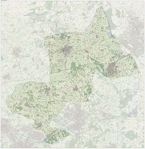
Dutch Topographic map of the municipality of Dinkelland, June 2015.
References
- ↑ "Roel Cazemier" (in Dutch). Gemeente Dinkelland. Retrieved 27 March 2014.
- ↑ "Kerncijfers wijken en buurten" [Key figures for neighbourhoods]. CBS Statline (in Dutch). CBS. 2 July 2013. Retrieved 12 March 2014.
- ↑ "Postcodetool for 7591MA". Actueel Hoogtebestand Nederland (in Dutch). Het Waterschapshuis. Retrieved 27 March 2014.
- ↑ "Bevolkingsontwikkeling; regio per maand" [Population growth; regions per month]. CBS Statline (in Dutch). CBS. 26 June 2014. Retrieved 24 July 2014.
External links
 Media related to Dinkelland at Wikimedia Commons
- Official website (Dutch)
 |
Neuenhaus (DE-NI) | Nordhorn (DE-NI) | | |
| Tubbergen | |
|||
| ||||
| | ||||
| Borne | Hengelo, Enschede, Oldenzaal | Losser |
Municipalities of Overijssel | ||
|---|---|---|
 | ||
| ||
This article is issued from Wikipedia - version of the 7/22/2015. The text is available under the Creative Commons Attribution/Share Alike but additional terms may apply for the media files.