Drietabbetje Airstrip
| Drietabbetje Airstrip | |||||||||||
|---|---|---|---|---|---|---|---|---|---|---|---|
| IATA: DRJ – ICAO: SMDA | |||||||||||
| Summary | |||||||||||
| Airport type | Public | ||||||||||
| Operator | Luchtvaartdienst Suriname | ||||||||||
| Location | Drietabbetje, Sipaliwini District, Suriname | ||||||||||
| Elevation AMSL | 236 ft / 72 m | ||||||||||
| Coordinates | 4°06′40″N 54°40′22″W / 4.11111°N 54.67278°WCoordinates: 4°06′40″N 54°40′22″W / 4.11111°N 54.67278°W | ||||||||||
| Map | |||||||||||
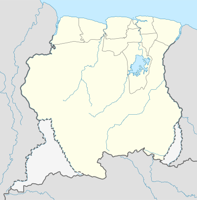 SMDA Location in Suriname | |||||||||||
| Runways | |||||||||||
| |||||||||||
Drietabbetje Airstrip (IATA: DRJ, ICAO: SMDA) serves the Tapanahony River village of Drietabbetje, Suriname.
Airlines and destinations
| Airlines | Destinations |
|---|---|
| Caricom Airways | Paramaribo-Zorg en Hoop Airport |
| Gum Air | Paramaribo-Zorg en Hoop Airport[3] |
Charter
| Airlines | Destinations |
|---|---|
| Blue Wing Airlines | Paramaribo-Zorg en Hoop Airport[4] |
| Gum Air | Paramaribo-Zorg en Hoop Airport[3] |
| Hi-Jet Helicopter Services | Paramaribo-Zorg en Hoop Airport |
| Suriname Air Force/Surinaamse Luchtmacht | Paramaribo-Zorg en Hoop Airport |
See also
 Suriname portal
 Aviation portal
- List of airports in Suriname
- Transport in Suriname
References
- ↑ Airport information for DRJ at Great Circle Mapper.
- ↑ Google Maps - Drietabbetje
- 1 2 Gum Air destinations
- ↑ Blue Wing schedule
External links
This article is issued from Wikipedia - version of the 12/4/2016. The text is available under the Creative Commons Attribution/Share Alike but additional terms may apply for the media files.