Duhabi, Kosi
| Duhabi दुहवी Krishnanagar | |
|---|---|
| municipality | |
| Nickname(s): K | |
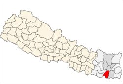
 Duhabi Location in Nepal | |
| Coordinates: 26°35′N 87°17′E / 26.58°N 87.28°ECoordinates: 26°35′N 87°17′E / 26.58°N 87.28°E | |
| Country |
|
| Zone | Kosi Zone |
| District | Sunsari District |
| Population (1991) | |
| • Total | 11,286 |
| Time zone | NST (UTC+5:45) |
| Postal code | 56707 |
| Area code(s) | 025 |
Duhabi is a municipality in Sunsari District in the Koshi Zone of south-eastern Nepal. At the time of the 2001 Nepal census it had a population of 17,574.[1] Duhabi is situated in between Itahari and Biratnagar, in the bank of Budi river. It is the center of Sunsari-Morang Industrial corridor.
References
- ↑ "Nepal Census 2001". Nepal's Village Development Committees. Digital Himalaya. Retrieved 2 December 2008.
This article is issued from Wikipedia - version of the 5/30/2016. The text is available under the Creative Commons Attribution/Share Alike but additional terms may apply for the media files.