Ein Tamar
| Ein Tamar עֵין תָּמָר | |
|---|---|
|
Entrance to Ein Tamar | |
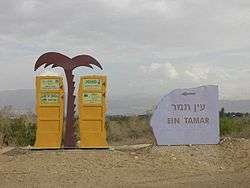
 Ein Tamar | |
| Coordinates: 30°56′31.2″N 35°22′18.83″E / 30.942000°N 35.3718972°ECoordinates: 30°56′31.2″N 35°22′18.83″E / 30.942000°N 35.3718972°E | |
| District | Southern |
| Council | Tamar |
| Affiliation | Agricultural Union |
| Founded | 1982 |
| Population (2015)[1] | 190 |
| Name meaning | Date Spring |
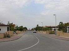
A neighbourhood in Ein Tamar
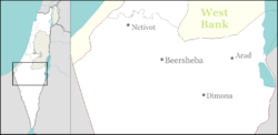
Ein Tamar (Hebrew: עֵין תָּמָר, lit. Date Spring) is a moshav in the northern Arabah valley in Israel. Located south of the Dead Sea, it falls under the jurisdiction of Tamar Regional Council. In 2015 it had a population of 190.
History
The moshav was established in August 1982 by 24 families.
The historical, biblical (Ezekiel 47:19) village of Tamar is probably located in the Hatzeva Fortress near Ir Ovot.
References
- ↑ "List of localities, in Alphabetical order" (PDF). Israel Central Bureau of Statistics. Retrieved 16 October 2016.
External links
- Ein Tamar Center for the Development of the Negev and Galilee
This article is issued from Wikipedia - version of the 9/5/2016. The text is available under the Creative Commons Attribution/Share Alike but additional terms may apply for the media files.