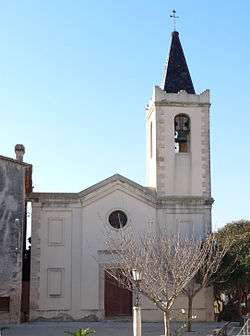
Els Garidells
| Els Garidells | |
|---|---|
| Municipality | |
 | |
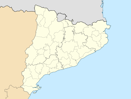 Els Garidells Location in Catalonia | |
| Coordinates: 41°12′33″N 1°14′55″E / 41.20917°N 1.24861°E | |
| Country |
|
| Community | Catalonia |
| Province | Tarragona |
| Comarca | Alt Camp |
| Government | |
| • Mayor | Marc Bigordà Prió (2015)[1] |
| Area[2] | |
| • Total | 3.1 km2 (1.2 sq mi) |
| Elevation | 132 m (433 ft) |
| Population (2014)[1] | |
| • Total | 182 |
| • Density | 59/km2 (150/sq mi) |
| Demonym(s) | Garidellenc, garidellenca |
| Postal code | 43153 |
| Website |
www |
Els Garidells is a municipality in the comarca of the Alt Camp in Catalonia, Spain. It is situated on the right bank of the Francolí river. A local road links the village with the N-240 road between Valls and Tarragona.
Els Garidells became part of the Alt Camp in the comarcal revision of 1990: previously it formed part of the Tarragonès.
References
- 1 2 "Ajuntament dels Garidells". Generalitat of Catalonia. Retrieved 2015-11-13.
- ↑ "El municipi en xifres: Els Garidells". Statistical Institute of Catalonia. Retrieved 2015-11-23.
- Panareda Clopés, Josep Maria; Rios Calvet, Jaume; Rabella Vives, Josep Maria (1989). Guia de Catalunya, Barcelona:Caixa de Catalunya. ISBN 84-87135-01-3 (Spanish). ISBN 84-87135-02-1 (Catalan).
External links
- Official website (Catalan)
- Information - Generalitat de Catalunya (Catalan)
- Statistical information - Institut d'Estadística de Catalunya (Catalan)
 |
Vallmoll | | ||
| El Morell | |
La Secuita | ||
| ||||
| | ||||
| Perafort |
Municipalities of Alt Camp | ||
|---|---|---|
This article is issued from Wikipedia - version of the 8/26/2016. The text is available under the Creative Commons Attribution/Share Alike but additional terms may apply for the media files.