Emmerthal
| Emmerthal | ||
|---|---|---|
| ||
 Emmerthal | ||
Location of Emmerthal within Hameln-Pyrmont district 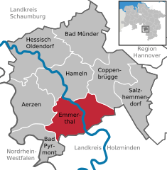
 | ||
| Coordinates: 52°3′N 9°23′E / 52.050°N 9.383°ECoordinates: 52°3′N 9°23′E / 52.050°N 9.383°E | ||
| Country | Germany | |
| State | Lower Saxony | |
| District | Hameln-Pyrmont | |
| Government | ||
| • Mayor | Andreas Grossmann | |
| Area | ||
| • Total | 115 km2 (44 sq mi) | |
| Population (2015-12-31)[1] | ||
| • Total | 9,876 | |
| • Density | 86/km2 (220/sq mi) | |
| Time zone | CET/CEST (UTC+1/+2) | |
| Postal codes | 31860 | |
| Dialling codes | 05155, 05157, 05286 | |
| Vehicle registration | HM | |
| Website | www.emmerthal.de | |

Emmerthal is a municipality in the Hamelin-Pyrmont district, in Lower Saxony, Germany. It is situated on the river Weser, approximatively 6 km south of Hamelin. Its seat is in the village Kirchohsen.
On a field on the nearby hill of the Bückeberg the Nazis used to hold their Reichs harvest festival.
References
Towns and municipalities in Hamelin-Pyrmont (district) | ||
|---|---|---|
This article is issued from Wikipedia - version of the 6/23/2015. The text is available under the Creative Commons Attribution/Share Alike but additional terms may apply for the media files.