Escudilla Bonita, New Mexico
| Escudilla Bonita, New Mexico | |
|---|---|
| Census-designated place | |
 Escudilla Bonita | |
| Coordinates: 34°06′44″N 109°01′23″W / 34.11222°N 109.02306°WCoordinates: 34°06′44″N 109°01′23″W / 34.11222°N 109.02306°W | |
| Country | United States |
| State | New Mexico |
| County | Catron |
| Area[1] | |
| • Total | 12.194 sq mi (31.58 km2) |
| • Land | 12.159 sq mi (31.49 km2) |
| • Water | 0.035 sq mi (0.09 km2) |
| Elevation | 7,316 ft (2,230 m) |
| Population (2010)[1] | |
| • Total | 119 |
| • Density | 9.8/sq mi (3.8/km2) |
| Time zone | Mountain (MST) (UTC-7) |
| • Summer (DST) | MDT (UTC-6) |
| Area code(s) | 575 |
| GNIS feature ID | 2584097[2] |
Escudilla Bonita is a census-designated place in Catron County, New Mexico, United States. Its population was 119 as of the 2010 census.[1]
Geography
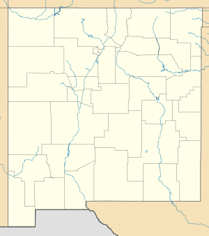
Escudilla Bonita is located at 34°06′36″N 109°01′22″W / 34.110067°N 109.022770°W. According to the U.S. Census Bureau, the community has an area of 12.194 square miles (31.58 km2); 12.159 square miles (31.49 km2) of its area is land, and 0.035 square miles (0.091 km2) is water.[1]
References
Municipalities and communities of Catron County, New Mexico, United States | ||
|---|---|---|
| Village | 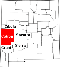 | |
| CDPs | ||
| Other unincorporated communities | ||
| Ghost towns |
| |
This article is issued from Wikipedia - version of the 10/16/2014. The text is available under the Creative Commons Attribution/Share Alike but additional terms may apply for the media files.