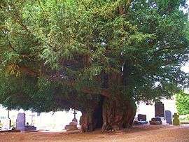
Estry
| Estry | |
|---|---|
 | |
 Estry | |
|
Location within Normandy region 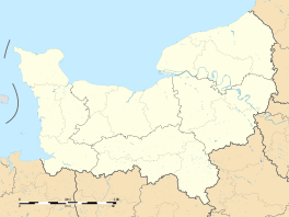 Estry | |
| Coordinates: 48°53′53″N 0°44′02″W / 48.8981°N 0.7339°WCoordinates: 48°53′53″N 0°44′02″W / 48.8981°N 0.7339°W | |
| Country | France |
| Region | Normandy |
| Department | Calvados |
| Arrondissement | Vire |
| Canton | Condé-sur-Noireau |
| Government | |
| • Mayor (2008–2014) | Didier Renouf |
| Area1 | 10.75 km2 (4.15 sq mi) |
| Population (2008)2 | 356 |
| • Density | 33/km2 (86/sq mi) |
| Time zone | CET (UTC+1) |
| • Summer (DST) | CEST (UTC+2) |
| INSEE/Postal code | 14253 / 14410 |
| Elevation |
143–245 m (469–804 ft) (avg. 240 m or 790 ft) |
|
1 French Land Register data, which excludes lakes, ponds, glaciers > 1 km² (0.386 sq mi or 247 acres) and river estuaries. 2 Population without double counting: residents of multiple communes (e.g., students and military personnel) only counted once. | |
Estry is a former commune in the Calvados department in the Normandy region in northwestern France. On 1 January 2016, it was merged into the new commune of Valdallière.[1]
Population
| Historical population | ||
|---|---|---|
| Year | Pop. | ±% |
| 1962 | 425 | — |
| 1968 | 436 | +2.6% |
| 1975 | 378 | −13.3% |
| 1982 | 368 | −2.6% |
| 1990 | 322 | −12.5% |
| 1999 | 336 | +4.3% |
| 2008 | 356 | +6.0% |
See also
References
- ↑ Arrêté préfectoral 13 October 2015 (French)
| Wikimedia Commons has media related to Estry (Calvados). |
This article is issued from Wikipedia - version of the 7/20/2016. The text is available under the Creative Commons Attribution/Share Alike but additional terms may apply for the media files.