Etwatwa
| Etwatwa | |
|---|---|
 Etwatwa  Etwatwa  Etwatwa
| |
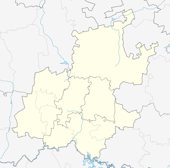
| Coordinates: 26°06′54″S 28°27′47″E / 26.115°S 28.463°ECoordinates: 26°06′54″S 28°27′47″E / 26.115°S 28.463°E | |
| Country | South Africa |
| Province | Gauteng |
| Municipality | Ekurhuleni |
| Area[1] | |
| • Total | 20.83 km2 (8.04 sq mi) |
| Population (2011)[1] | |
| • Total | 151,866 |
| • Density | 7,300/km2 (19,000/sq mi) |
| Racial makeup (2011)[1] | |
| • Black African | 99.3% |
| • Coloured | 0.3% |
| • Indian/Asian | 0.2% |
| • White | 0.1% |
| • Other | 0.2% |
| First languages (2011)[1] | |
| • Zulu | 44.9% |
| • Tsonga | 12.9% |
| • Northern Sotho | 12.1% |
| • Sotho | 7.3% |
| • Other | 22.7% |
| Postal code (street) | 1520 |
| Area code | 011 |
Etwatwa is a township near Benoni in Ekurhuleni in the Gauteng province of South Africa.
References
- 1 2 3 4 "Main Place Etwatwa". Census 2011.
Communities of Ekurhuleni Metropolitan Municipality, Gauteng | ||
|---|---|---|
Seat: Germiston | ||
| Cities and towns | .svg.png) | |
| Suburbs of Kempton Park | ||
This article is issued from Wikipedia - version of the 4/4/2016. The text is available under the Creative Commons Attribution/Share Alike but additional terms may apply for the media files.