Falakata
| Falakata, West Bengal ফালাকাটা | |
|---|---|
| Town | |
|
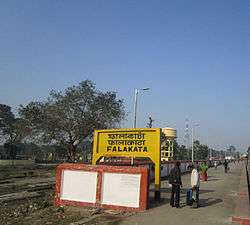
Falakata Station nameplate | |
 Falakata, West Bengal  Falakata, West Bengal Location in West Bengal, India | |
| Coordinates: 26°32′N 89°12′E / 26.53°N 89.2°ECoordinates: 26°32′N 89°12′E / 26.53°N 89.2°E | |
| Country |
|
| State | West Bengal |
| District | Alipurduar |
| Government | |
| • Type | West Bengal |
| Elevation | 88 m (289 ft) |
| Population (2001) | |
| • Total | 18,801 |
| Languages | |
| • Official | Bengali, English |
| Time zone | IST (UTC+5:30) |
| Vehicle registration | WB |
| Lok Sabha constituency | Alipurduars (SC) |
| Vidhan Sabha constituency | Falakata (SC) |
| Website |
jalpaiguri |
Falakata is a census town and police station of Alipurduar subdivision[1] in Alipurduar district in the state of West Bengal, India.
Geography
Falakata is located at 26°32′N 89°12′E / 26.53°N 89.2°E It has an average elevation of 88 metres (288 feet). This place is a recently declared Municipality. Mujnai is the main river. Falakata is surrounded by rich forests, corn fields and the nearby Kunjanagar Eco-Park.
Demographics
As of 2001 India census,[2] Falakata had a population of 18,801. Males constitute 51% of the population and females 49%. Falakata has an average literacy rate of 76%, higher than the national average of 59.5%: male literacy is 81%, and female literacy is 71%. In Falakata, 12% of the population is under 6 years of age.
Education
Falakata College is one of the very prominent Colleges.It offers only Arts stream.
References
- ↑ District-wise list of statutory towns
- ↑ "Census of India 2001: Data from the 2001 Census, including cities, villages and towns (Provisional)". Census Commission of India. Archived from the original on 2004-06-16. Retrieved 2008-11-01.
Cities, towns and locations in Alipurduar district | |||
|---|---|---|---|
| Cities, municipal and census towns |
| ||
| Locations other than cities and towns | |||
| Related Topics |
| ||