Ferdows Hole-in-the-Rock
Coordinates: 34°08′45.7″N 57°50′24″E / 34.146028°N 57.84000°E / 34.146028; 57.84000
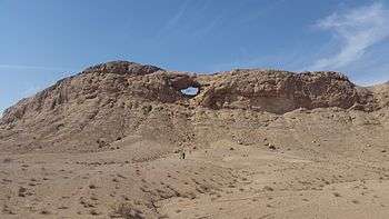
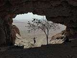
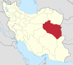
Ferdows Hole-in-the-Rock (Persian: سنگ سوراخ فردوس – Sang-e-Sourakh Ferdows) is a natural geological formation 35 km (22 mi) west of Ferdows, South Khorasan Province, Iran.
Description
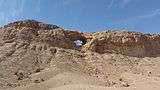
Ferdows Hole-in-the-Rock is an elliptical opening around 20 metres (66 ft) wide eroded in a Limestone hill.[1]
The formation is a popular attraction in the Mozaffari protected area in Ferdows County.
This natural attraction, locates 500 meters besides the old road of Ebrahimabad to Kajeh, Chahno and Polond desert.
Gallery
| Ferdows Hole-in-the-Rock |
|---|
| Ferdows Hole-in-the-Rock, located in Ferdows county. |
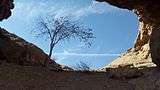
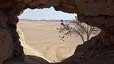
| View from inside Ferdows Hole-in-the-Rock. |
| View from inside Ferdows Hole-in-the-Rock. |
| View from inside Ferdows Hole-in-the-Rock. |
| View from inside Ferdows Hole-in-the-Rock. |
|
Notes