Ferris Mountains
| Ferris Mountains | |
|---|---|
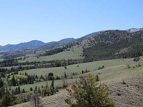 North face of Ferris Mountains | |
| Highest point | |
| Peak | Ferris Peak |
| Elevation | 10,037 ft (3,059 m) |
| Coordinates | 42°15′25″N 107°14′22″W / 42.25694°N 107.23944°WCoordinates: 42°15′25″N 107°14′22″W / 42.25694°N 107.23944°W |
| Geography | |
| Country | United States |
| State | Wyoming |
The Ferris Mountains are a small mountain range in Carbon County, Wyoming.[1] The highest peak in the range is Ferris Peak, which rises to an elevation of 10,037 feet (3,059 m).[2] Most of the range is covered by a BLM Wilderness Study Area.[2]
See also
Notes
- ↑ "Ferris Mountains". Geographic Names Information System. United States Geological Survey.
- 1 2 "Ferris Mountain WSA". United States Bureau of Land Management. Retrieved 8 June 2014.
Cheyenne (capital) | |
| Topics |
|
| Society |
|
| Regions | |
| Cities | |
| Counties | |
This article is issued from Wikipedia - version of the 11/1/2014. The text is available under the Creative Commons Attribution/Share Alike but additional terms may apply for the media files.