Fosselvi
| Fosselvi | |
| River | |
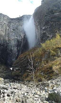 image of the river Fosselvi and Vettisfossen | |
| Countries | Norway, Utladalen |
|---|---|
| District | Sogn og Fjordane |
| Municipality | Årdal |
| Source | Vettisfossen |
| - location | Årdal, Utladalen, Norway |
| - elevation | 501 m (1,644 ft) |
| - coordinates | 61°22′45″N 07°56′51″E / 61.37917°N 7.94750°E |
| Mouth | the river Utla |
| - location | Utla, Utladalen, Norway |
| - elevation | 276 m (906 ft) |
| - coordinates | 61°22′56″N 07°56′19″E / 61.38222°N 7.93861°ECoordinates: 61°22′56″N 07°56′19″E / 61.38222°N 7.93861°E |
| Length | 0.4733 km (0 mi) |
| Width | 0.0158 km (0 mi) |
| Depth | 0.73 m (2 ft) |
| Volume | 4 m3 (141 cu ft) |
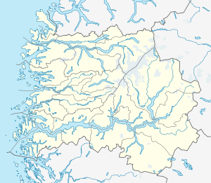 Fosselvi route | |
Fosselvi is a river in the municipality of Årdal in Sogn og Fjordane county, Norway. It has a length of 473.3 meters, starting at 501 m a.s.l. from Vettisfossen waterfall, assuming rapids and rocks exposed above the flow surface and reaching towards the river Utla in Sogn og Fjordane at 276 m a.s.l. in the valley Utladalen.
References
External links
 Media related to Fosselvi at Wikimedia Commons
This article is issued from Wikipedia - version of the 11/16/2016. The text is available under the Creative Commons Attribution/Share Alike but additional terms may apply for the media files.